CRISM Web Site (original) (raw)
Mission Elapsed Time
| Beginning 12 Aug. 2005, 11:43:00 UTC | |||
|---|---|---|---|
| DAYS | HRS | MINS | SECS |
 |
|
|
|
CRISM Downloads
CRISM View
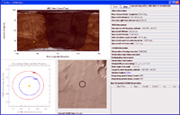
CRISM View is a first-of-its-kind opportunity to watch Mars through the “eyes” of the Compact Reconnaissance Imaging Spectrometer for Mars (CRISM) – as if you were riding along with it on the Mars Reconnaissance Orbiter!
[ more ]
JCAT
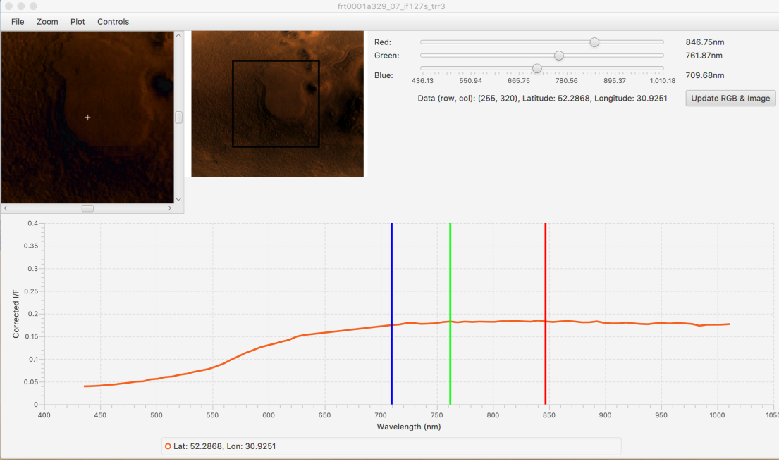
The Java CRISM Analysis Tool (JCAT) can be used to view CRISM data downloaded from the Planetary Data System (PDS) Geosciences Node at Washington University in St. Louis.
[ more ]
What is CRISM?
The Compact Reconnaissance Imaging Spectrometer for Mars (CRISM) is 1 of 6 science experiments on the Mars Reconnaissance Orbiter, which takes measurements of both the surface and the atmosphere of Mars.
CRISM data are used to find minerals’ spectral signatures on Mars. Different minerals form in different settings, ranging from ancient lakes and deltas to volcanic lava flows. We use the mineral evidence to understand how different geologic processes have shaped the planet over time. CRISM also observes the polar ice caps and atmosphere to understand seasonal and year-to-year variations in the Martian weather.
Mars Reconnaissance Orbiter Preparing for Years Ahead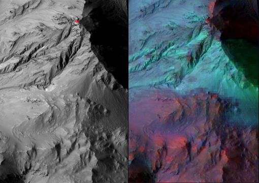
Mars Gullies Likely Not Formed By Liquid Water
Evidence Builds for Old Under-Ice Volcanoes on Mars
New CRISM Data Products Offer Greater Accessibility to Mars Researchers
Study Finds Evidence for More Recent Clay Formation on Mars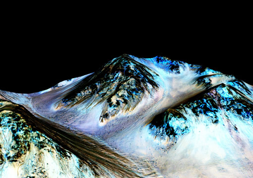
NASA Confirms Evidence That Liquid Water Flows on Today’s Mars
What Happened to Early Mars' Atmosphere? New Study Eliminates One Theory
Martian glass: Window into possible past life?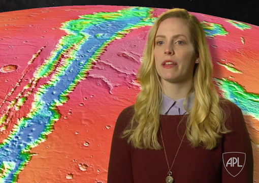
APL’s C. Beck describes how CRISM helps researchers understand the history and formation of Valles Marineris.
Ancient Martian lake system records two water-related events
CRISM Reveals New Images of Comet Siding Spring's Coma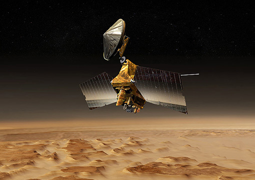
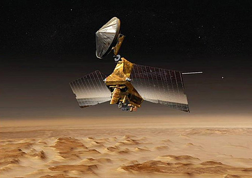
CRISM (shown here on NASA's Mars Reconnaissance Orbiter) delivers important new science and shows the way for past, present and future Mars rovers.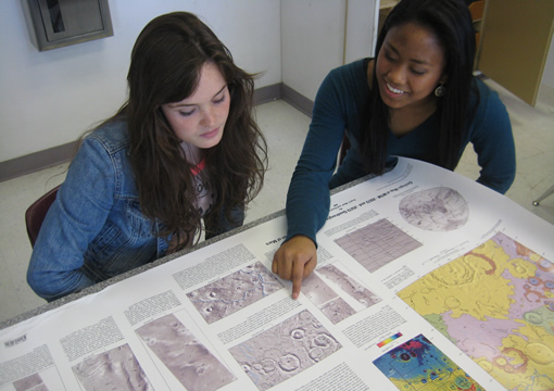
MESDT (Mars Exploration Student Data Teams) participants discuss Martian geology.
February 9, 2018
Mars Reconnaissance Orbiter Preparing for Years Ahead
Teams operating the two instruments aboard NASA's Mars Reconnaissance Orbiter (MRO) named most often in research papers -- the High Resolution Imaging Science Experiment (HiRISE) camera and the CRISM mineral-mapper -- are dealing with challenges but are ready to continue providing valuable observations. [more]
January 11, 2018
Steep Slopes on Mars Reveal Structure of Buried Ice
Researchers using CRISM and other instruments have found eight sites where thick deposits of ice beneath Mars' surface are exposed in faces of eroding slopes. [more]
July 29, 2016
Mars Gullies Likely Not Formed By Liquid Water
New findings using CRISM data show that gullies on modern Mars are most likely not being formed by flowing liquid water. This new evidence will allow researchers to further narrow theories as to the mechanisms behind the formation of gullies on Mars. [more]
June 15, 2016
Spectroscopy on Mars: A Look at What’s Been Uncovered About the Red Planet
In this interview by Spectroscopy Editors, CRISM Co-Investigator Ray Arvidson discusses "how spectroscopy has played a significant role in the Mars expeditions, including the confirmation of the former presence of water on the Red Planet." [more]
May 3, 2016
CRISM Reveals Clues about Volcanoes Under Ice on Ancient Mars
Volcanoes erupted beneath an ice sheet on Mars billions of years ago, far from any ice sheet on the Red Planet today, new evidence from CRISM suggests. [more]
March 17, 2016
New CRISM Data Products Offer Greater Accessibility to Mars Researchers
CRISM has acquired tens of thousands of targeted, high-resolution, hyperspectra Mars observations – and now, thanks to two new data products in the Planetary Data System, that data will be much more accessible to researchers. [more]
The MRO CRISM Spectral Library is an analysis tool for interpreting CRISM data. it currently contains 2,260 spectral analyses of 1,134 Mars-analog samples, all measured under desiccating conditions so that materials that adsorb water look as they would on Mars. This was made avaialble to the community through the PDS on the day that MRO entered Mars orbit!
The MICA Files »
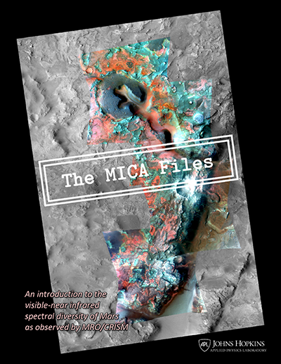
The MICA Files is a compilation of published descriptions and type locations of unique spectral features identified on Mars by using data from CRISM. Learn more »
CRISM Quickmap
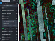
View and access high resolution targeted data and map tile browse products in context with other Mars datasets. [ more ]
Revealing Questions
How does CRISM measure the surface and the atmosphere?
CRISM is a hyperspectral reflectance spectrometer. That means that CRISM measures sunlight that passes through Mars’ atmosphere, hits the surface and interacts with the materials there, then “reflects” back through the atmosphere and into space where the instrument records the amount of light received at each of hundreds of different wavelengths. Different types of minerals on the surface and dust, ice, and gases in the atmosphere absorb the sunlight at particular wavelengths. The wavelengths where the light is absorbed is a fingerprint of the minerals, ices, and gases on the surface and in the atmosphere. Usually CRISM looks "down" at a target as the MRO spacecraft flies over it. Sometimes, CRISM is pointed at the horizon, or limb, of Mars in order to better see the vertical structure of the atmosphere, like clouds!
CRISM Facts