Bad Sulza (original) (raw)
From Wikipedia, the free encyclopedia
Town in Thuringia, Germany
| Bad Sulza | |
|---|---|
| Town | |
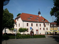
 Town hall Town hall |
|
 Coat of arms Coat of arms |
|
Location of Bad Sulza within Weimarer Land district  |
|
  Bad Sulza Show map of Germany Bad Sulza Show map of Germany  Bad Sulza Show map of Thuringia Bad Sulza Show map of Thuringia |
|
| Coordinates: 51°5′15″N 11°37′20″E / 51.08750°N 11.62222°E / 51.08750; 11.62222 | |
| Country | Germany |
| State | Thuringia |
| District | Weimarer Land |
| Government | |
| • Mayor (2024–30) | Dirk Schütze[1] |
| Area | |
| • Total | 94.10 km2 (36.33 sq mi) |
| Elevation | 140 m (460 ft) |
| Population (2022-12-31)[2] | |
| • Total | 8,037 |
| • Density | 85/km2 (220/sq mi) |
| Time zone | UTC+01:00 (CET) |
| • Summer (DST) | UTC+02:00 (CEST) |
| Postal codes | 99518, 99510 (Flurstedt, Gebstedt, Wickerstedt) |
| Dialling codes | 036461 |
| Vehicle registration | AP, APD |
| Website | www.bad-sulza.de |
Bad Sulza (German pronunciation: [baːt ˈzʊltsa] ⓘ) is a town in the Weimarer Land district, in Thuringia, Germany. It is situated on the river Ilm, 15 km southwest of Naumburg, and 18 km north of Jena.
Within the German Empire (1871-1918), Bad Sulza was part of the Grand Duchy of Saxe-Weimar-Eisenach. The former municipality Ködderitzsch was merged into Bad Sulza in January 2019, and Saaleplatte in December 2019. In January 2023 Bad Sulza absorbed the former municipality Rannstedt.[3]
- Johann Agricola (1590-1668), superintendent of the salt plant from 1622 to 1631, used the healing power of Sulza brine for therapeutic purposes.
- Adolf Piltz (1855-1940), German mathematician notable for his work in number theory.
Associated with the city
[edit]
- Thomas Naogeorgus (actually Kirchmair) (1508-1563), theologian, Neo-Latin poet and playwright
- ^ Gewählte Bürgermeister - aktuelle Landesübersicht, Freistaat Thüringen. Retrieved 25 June 2024.
- ^ "Bevölkerung der Gemeinden, erfüllenden Gemeinden und Verwaltungsgemeinschaften in Thüringen Gebietsstand: 31.12.2022" (in German). Thüringer Landesamt für Statistik. June 2023.
- ^ "Thüringer Gesetz- und Verordnungsblatt Nr. 26/2022" (PDF). 20 December 2022. p. 476.
 Media related to Bad Sulza at Wikimedia Commons