Bohlinryggen (original) (raw)
From Wikipedia, the free encyclopedia
Mountain ridge in Spitsbergen, Norway
| Bohlinryggen | |
|---|---|
 Bohlinryggen in front with Renardbreen to the left. In the background is the valley of Dunderdalen. Bohlinryggen in front with Renardbreen to the left. In the background is the valley of Dunderdalen. |
|
| Highest point | |
| Elevation | 716 m (2,349 ft) |
| Coordinates | 77°32′06″N 14°23′34″E / 77.5350°N 14.3927°E / 77.5350; 14.3927 |
| Geography | |
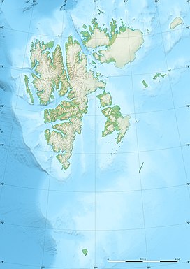
  BohlinryggenWedel Jarlsberg Land at Spitsbergen, Svalbard, NorwayShow map of Svalbard BohlinryggenWedel Jarlsberg Land at Spitsbergen, Svalbard, NorwayShow map of Svalbard  BohlinryggenBohlinryggen (Arctic)Show map of Arctic BohlinryggenBohlinryggen (Arctic)Show map of Arctic |
Bohlinryggen is a mountain ridge in Wedel Jarlsberg Land at Spitsbergen, Svalbard. It has a length of about 4.5 kilometers, and the highest peak is 716 m.a.s.l. It is located between the glaciers Scottbreen and Renardbreen. The ridge is named after Swedish astronomer Karl Bohlin.[1]
- ^ "Bohlinryggen (Svalbard)". Norwegian Polar Institute. Archived from the original on 6 May 2016. Retrieved 29 September 2013.