Eslourenties-Daban (original) (raw)
Commune in Nouvelle-Aquitaine, France
| Eslourenties-Daban | |
|---|---|
| Commune | |
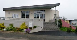
 The town hall of Eslourenties-Daban The town hall of Eslourenties-Daban |
|
 Coat of arms Coat of arms |
|
Location of Eslourenties-Daban  |
|
  Eslourenties-DabanShow map of France Eslourenties-DabanShow map of France  Eslourenties-DabanShow map of Nouvelle-Aquitaine Eslourenties-DabanShow map of Nouvelle-Aquitaine |
|
| Coordinates: 43°18′01″N 0°08′29″W / 43.3003°N 0.1414°W / 43.3003; -0.1414 | |
| Country | France |
| Region | Nouvelle-Aquitaine |
| Department | Pyrénées-Atlantiques |
| Arrondissement | Pau |
| Canton | Pays de Morlaàs et du Montanérès |
| Intercommunality | Nord-Est Béarn |
| Government | |
| • Mayor (2020–2026) | Xavier Boudigue[1] |
| Area1 | 5.06 km2 (1.95 sq mi) |
| Population (2021)[2] | 372 |
| • Density | 74/km2 (190/sq mi) |
| Time zone | UTC+01:00 (CET) |
| • Summer (DST) | UTC+02:00 (CEST) |
| INSEE/Postal code | 64211 /64420 |
| Elevation | 329–398 m (1,079–1,306 ft) (avg. 390 m or 1,280 ft) |
| 1 French Land Register data, which excludes lakes, ponds, glaciers > 1 km2 (0.386 sq mi or 247 acres) and river estuaries. |
Eslourenties-Daban (French pronunciation: [ɛsluʁɛ̃tis dabɑ̃]; Occitan: Es·hlorentias) is a commune in the Pyrénées-Atlantiques department and Nouvelle-Aquitaine region of south-western France.
Eslourenties-Daban is located twenty kilometers east of Pau. The river Gabas, a tributary of the Adour, flows through the commune.[3]
Paul Raymond notes that in 1385, Eslourenties-Daban had seven fires and depended on the bailiwick of Pau. This commune was the chief town of the notairie des Lannes and Rivière-Ousse, then during the 18th century of the notairie des Lannes only. The remains of a fortified complex from the 11th century bear witness to the ancient past of the commune.[4]
Eslourenties-Daban is part of four intermunicipal structures:
- The Community of Municipalities of Nord-Est Béarn;
- The school union of Eslourenties - Lourenties - Limendous;
- The energy syndicate of Pyrénées-Atlantiques;
- The intercommunal drinking water supply syndicate of Luy - Gabas - Lées.
Eslourenties-Daban is home to the headquarters of the Eslourenties-Lourenties-Limendous school union.
In 2018, the commune had 353 inhabitants.[5]
The church of St. Martin dates from the 19th century. It contains furniture, a processional cross, a statue, and canopies, referenced in the general inventory of cultural heritage.[6]
Environmental heritage
[edit]
The lake of Gabas, a 216ha lake is used for irrigation and is a support of low water level.
The commune also has an environmental pole for fishing intended for environmental education, and a Fishing and Nature House, with a showroom specially equipped for the handicapped. The Handi-fishing pole promotes the practice of leisure fishing for all publics and is specially equipped to welcome the disabled and has received the label Tourisme Handicap.
- ^ "Répertoire national des élus: les maires". data.gouv.fr, Plateforme ouverte des données publiques françaises (in French). 2 December 2020.
- ^ "Populations légales 2021" (in French). The National Institute of Statistics and Economic Studies. 28 December 2023.
- ^ Sandre. "Fiche cours d'eau - Le Gabas (Q13-0400)".
- ^ Base Mérimée: Ensemble fortifié, Ministère français de la Culture. (in French)
- ^ Téléchargement du fichier d'ensemble des populations légales en 2018, INSEE
- ^ Base Mérimée: Eglise paroissiale Saint-Martin, Ministère français de la Culture. (in French)