Georgenthal (original) (raw)
From Wikipedia, the free encyclopedia
Municipality in Thuringia, Germany
| Georgenthal | |
|---|---|
| Municipality | |
 Saint Elisabeth Church Saint Elisabeth Church |
|
 Coat of arms Coat of arms |
|
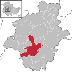
Location of Georgenthal within Gotha district  |
|
  Georgenthal Show map of Germany Georgenthal Show map of Germany  Georgenthal Show map of Thuringia Georgenthal Show map of Thuringia |
|
| Coordinates: 50°49′N 10°40′E / 50.817°N 10.667°E / 50.817; 10.667 | |
| Country | Germany |
| State | Thuringia |
| District | Gotha |
| Government | |
| • Mayor (2020–26) | Florian Hofmann[1] |
| Area | |
| • Total | 79.15 km2 (30.56 sq mi) |
| Elevation | 390 m (1,280 ft) |
| Population (2022-12-31)[2] | |
| • Total | 7,991 |
| • Density | 100/km2 (260/sq mi) |
| Time zone | UTC+01:00 (CET) |
| • Summer (DST) | UTC+02:00 (CEST) |
| Postal codes | 99887 |
| Dialling codes | 036253 |
| Vehicle registration | GTH |
| Website | www.georgenthal.de |
Georgenthal is a municipality in the district of Gotha, in Thuringia, Germany. The former municipalities Leinatal, Hohenkirchen and Petriroda were merged into Georgenthal in December 2019. The former municipality Herrenhof was merged into Georgenthal in January 2024.[3]
- ^ Gewählte Bürgermeister - aktuelle Landesübersicht, Freistaat Thüringen, accessed 14 July 2021.
- ^ "Bevölkerung der Gemeinden, erfüllenden Gemeinden und Verwaltungsgemeinschaften in Thüringen Gebietsstand: 31.12.2022" (in German). Thüringer Landesamt für Statistik. June 2023.
- ^ Thüringer Gesetz zur freiwilligen Neugliederung kreisangehöriger Gemeinden im Jahr 2024, Gesetz- und Verordnungsblatt für den Freistaat Thüringen, 2023 Nr. 15, pp. 348-349