Havelock Town (original) (raw)
From Wikipedia, the free encyclopedia
Suburb in Western Province, Sri Lanka
| Havelock Town තිඹිරිගස්යායஹெவ்லொக் நகரம் | |
|---|---|
| Suburb | |
 Residential buildings in Havelock City Residential buildings in Havelock City |
|
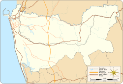
  Havelock TownLocation in Colombo District Havelock TownLocation in Colombo District |
|
| Coordinates: 6°52′46″N 79°51′55″E / 6.87944°N 79.86528°E / 6.87944; 79.86528 | |
| Country | Sri Lanka |
| Province | Western Province |
| District | Colombo District |
| Time zone | UTC+5:30 (Sri Lanka Standard Time Zone) |
| Postal Code | 00500 [1] |
Havelock Town is a neighbourhood of Colombo, Sri Lanka, part of an area zoned as Colombo 5. It is located approximately 6 kilometres south of Fort, the central business district of Colombo. Havelock City, a mixed-used development in Havelock Town is to be the largest property development in Sri Lanka incorporating residential and commercial facilities.[2]
It is named after Arthur Havelock who served as the British governor of Ceylon from 1890 to 1895.[3]
- Isipathana College
- Hindu College, Colombo
- Visakha Vidyalaya
- Lumbini Vidyalaya
- Wesley College Primary School [4]
- Royal Institute International School
Diplomatic missions
[edit]
The Havelock Towers seen from Kirulapone.
- Isipathanaramaya Temple
- Edward Henry Pedris Grounds (Havelock Grounds)
- Edward Henry Pedris Children's Library
- Edward Henry Pedris Park
- Havelock Park
- ^ "Postal Code of Havelock Town (None) :: Mohanjith". Archived from the original on 2009-01-19. Retrieved 2009-03-24.
- ^ "Home". havelockcity.lk.
- ^ "Archived copy". Archived from the original on 2020-08-03. Retrieved 2019-11-30.
{{[cite web](/wiki/Template:Cite%5Fweb "Template:Cite web")}}: CS1 maint: archived copy as title (link) - ^ "Havelock Town". Wesley College. Retrieved 22 December 2017. Our Primary School which is situated in Havelock Town comprises of nearly 750 students.
