Iara, Cluj (original) (raw)
From Wikipedia, the free encyclopedia
Commune in Cluj, Romania
| Iara | |
|---|---|
| Commune | |
 View of the village of Agriș View of the village of Agriș |
|
 Location in Cluj County Location in Cluj County |
|
  IaraLocation in Romania IaraLocation in Romania |
|
| Coordinates: 46°33′11″N 23°31′04″E / 46.55306°N 23.51778°E / 46.55306; 23.51778 | |
| Country | Romania |
| County | Cluj |
| Established | 1176 |
| Subdivisions | Agriș, Borzești, Buru, Cacova Ierii, Făgetu Ierii, Iara, Lungești, Măgura Ierii, Mașca, Ocolișel, Surduc, Valea Agrișului, Valea Vadului |
| Government | |
| • Mayor (2020–2024) | Ioan Dorin Popa[1] (PNL) |
| Area | 143.87 km2 (55.55 sq mi) |
| Elevation | 465 m (1,526 ft) |
| Population (2021-12-01)[2] | 3,577 |
| • Density | 24.86/km2 (64.39/sq mi) |
| Time zone | EET/EEST (UTC+2/+3) |
| Postal code | 407315 |
| Area code | +(40) 0264 |
| Vehicle reg. | CJ |
| Website | primariaiara.ro |
Iara (Hungarian: Alsójára; German: Jahren) is a commune in the southern part of Cluj County, Transylvania, Romania. It is composed of thirteen villages: Agriș (Ruhaegres), Borzești (Berkes), Buru (Borrév), Cacova Ierii (Aranyosivánfalva), Făgetu Ierii (Bikalat), Iara, Lungești (Szurdoklunzsest), Măgura Ierii (Járamagura), Mașca (Macskakő), Ocolișel (Felsőaklos), Surduc (Járaszurdok), Valea Agrișului (Egrespatak), and Valea Vadului (Vádpatak).
According to the census from 2002, the commune had a population of 4,704, of which 90.68% were ethnic Romanians, 6.01% ethnic Roma, and 3.16% ethnic Hungarians.[3] At the 2021 census, Iara had a population of 3,577; of those, 83.45% were Romanians and 6.96% Roma.[4]
- ^ "Results of the 2020 local elections". Central Electoral Bureau. Retrieved 11 June 2021.
- ^ "2021 Romanian census". National Institute of Statistics.
- ^ "Structura Etno-demografică a României".
- ^ "Populația rezidentă după grupa de vârstă, pe județe și municipii, orașe, comune, la 1 decembrie 2021" (in Romanian). INSSE. 31 May 2023.

Archangels church in Borzești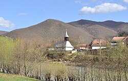
Buru
Wooden church in Ocolișel
Valea Vadului


