Maarheeze (original) (raw)
From Wikipedia, the free encyclopedia
For the villa in Wassenaar, former home of the Dutch Foreign Intelligence Service, see Villa Maarheeze.
Village in North Brabant, Netherlands
| Maarheeze | |
|---|---|
| Village | |
 Catholic church Catholic church |
|
 Flag Flag Coat of arms Coat of arms |
|
  MaarheezeLocation in North BrabantShow map of North Brabant MaarheezeLocation in North BrabantShow map of North Brabant MaarheezeMaarheeze (Netherlands)Show map of Netherlands MaarheezeMaarheeze (Netherlands)Show map of Netherlands MaarheezeMaarheeze (Europe)Show map of Europe MaarheezeMaarheeze (Europe)Show map of Europe |
|
| Coordinates: 51°18′39″N 5°36′48″E / 51.31083°N 5.61333°E / 51.31083; 5.61333 | |
| Country |  Netherlands Netherlands |
| Province |  North Brabant North Brabant |
| Municipality |  Cranendonck Cranendonck |
| Area[1] | |
| • Total | 1.85 km2 (0.71 sq mi) |
| Elevation[2] | 28 m (92 ft) |
| Population (2021)[1] | |
| • Total | 4,585 |
| • Density | 2,500/km2 (6,400/sq mi) |
| Time zone | UTC+1 (CET) |
| • Summer (DST) | UTC+2 (CEST) |
| Postal code | 6026[1] |
| Dialing code | 0495 |
Maarheeze is a village in the Dutch province of North Brabant. It is located in the municipality of Cranendonck, about 15 km southeast of Eindhoven, near the Belgian and the German borders.
The village was first mentioned in 1223 as in Marresia. The etymology is unclear.[3] Maarheeze is a church village which developed in the Early Middle Ages.[4]
Maarheeze was home to 220 people in 1840.[5] The Catholic St Gertrudis Church was built between 1909 and 1910 and has two towers.[4] In 1913, a railway station was built in Maarheeze, however it closed in 1938 and the building was demolished in 1966.[6] A new railway station was built in 2010.[7] In 1955, a factory was opened by Philips.[5]
Maarheeze used to be a separate municipality. It merged with Budel in 1997, and changed its name to Cranendonck.[8]
Though located in North Brabant near Eindhoven, the spoken dialect is Budels (linguistically a Limburgish dialect), rather than Kempenlands (linguistically an East Brabantian dialect).[9]
- Wendy van Eijk, politician
- ^ a b c "Kerncijfers wijken en buurten 2021". Central Bureau of Statistics. Retrieved 15 April 2022.
- ^ "Postcodetool for 6026AA". Actueel Hoogtebestand Nederland (in Dutch). Het Waterschapshuis. Retrieved 15 April 2022.
- ^ "Maarheeze - (geografische naam)". Etymologiebank (in Dutch). Retrieved 15 April 2022.
- ^ a b Chris Kolman & Ronald Stenvert (1997). Maarheeze (in Dutch). Zwolle: Waanders. ISBN 90 400 9945 6. Retrieved 15 April 2022.
- ^ a b "Maarheeze". Plaatsengids (in Dutch). Retrieved 15 April 2022.
- ^ "station Maarheeze". Stationweb (in Dutch). Retrieved 15 April 2022.
- ^ "station Maarheeze". Stationweb (in Dutch). Retrieved 15 April 2022.
- ^ Ad van der Meer and Onno Boonstra, Repertorium van Nederlandse gemeenten, KNAW, 2011.
- ^ Jos & Cor Swanenberg: Taal in stad en land: Oost-Brabants, ISBN 9012090105
Street of Maarheeze
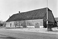
House in Maarheeze
Clergy house
Maarheeze railway station- Photos of Maarheeze


![]()
Wikimedia Commons has media related to Maarheeze.