Milcovul (original) (raw)
From Wikipedia, the free encyclopedia
Commune in Vrancea, Romania
| Milcovul | |
|---|---|
| Commune | |
 St. Catherine Church in Milcovul St. Catherine Church in Milcovul |
|
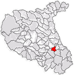
 Location in Vrancea County Location in Vrancea County |
|
  MilcovulLocation in Romania MilcovulLocation in Romania |
|
| Coordinates: 45°39′N 27°15′E / 45.650°N 27.250°E / 45.650; 27.250 | |
| Country | Romania |
| County | Vrancea |
| Government | |
| • Mayor (2020–2024) | Mihai Neață (PSD) |
| Area | 27.53 km2 (10.63 sq mi) |
| Elevation | 33 m (108 ft) |
| Population (2021-12-01)[1] | 3,537 |
| • Density | 130/km2 (330/sq mi) |
| Time zone | EET/EEST (UTC+2/+3) |
| Postal code | 627205 |
| Area code | +(40) 237 |
| Vehicle reg. | VN |
| Website | www.primariamilcovul.ro |
Milcovul (called Risipiți until 1964) is a commune in Vrancea County, Romania. It is located in the historical region of Muntenia. It is composed of two villages, Lămotești and Milcovul, and also included Gologanu and Răstoaca from 1968, until these became separate communes again in 2004.
The commune is situated in the northern reaches of the Wallachian Plain, on the banks of the Milcov River. It is located in the southeastern part of Vrancea County, 9 km (5.6 mi) southeast of the county seat, Focșani; its other neighbors are the following communes: Răstoaca to the northeast, Gologanu to the south, and Slobozia Ciorăști to the southwest. Milcovul is crossed by national road DN23A [ro], which connects Focșani to Ciorăști.
In 1227 Milcov became the seat of the Diocese of Cumania, a Roman Catholic bishopric which served the Cumans and the Teutonic Knights in the Burzenland. The diocese was destroyed during the Mongol invasion of Europe in 1241.[_citation needed_]