Peiwar Pass (original) (raw)
From Wikipedia, the free encyclopedia
Mountain pass on the Afghanistan–Pakistan border
| Peiwar Pass | |
|---|---|
 "Guns captured at the Peiwar Kotal and parked at Kohat" photograph by John Burke (photographer) during the Second Anglo-Afghan War "Guns captured at the Peiwar Kotal and parked at Kohat" photograph by John Burke (photographer) during the Second Anglo-Afghan War |
|
| Location | Afghanistan–Pakistan border |
| Range | Hindu Kush |
| Coordinates | 33°58′9″N 69°52′21″E / 33.96917°N 69.87250°E / 33.96917; 69.87250 |
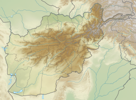
  Peiwar PassLocation of Peiwar PassShow map of Afghanistan Peiwar PassLocation of Peiwar PassShow map of Afghanistan  Peiwar PassPeiwar Pass (Khyber Pakhtunkhwa)Show map of Khyber Pakhtunkhwa Peiwar PassPeiwar Pass (Khyber Pakhtunkhwa)Show map of Khyber Pakhtunkhwa  Peiwar PassPeiwar Pass (FATA)Show map of FATA Peiwar PassPeiwar Pass (FATA)Show map of FATA  Peiwar PassPeiwar Pass (Pakistan)Show map of Pakistan Peiwar PassPeiwar Pass (Pakistan)Show map of Pakistan |
|
 |
The Peiwar Kotal Pass, also spelled Paywar, is a mountain pass in the Kurram Valley that connects Paktia Province in Afghanistan to Kurram District in the Khyber Pakhtunkhwa province of Pakistan.
In November 1878, during the Second Anglo-Afghan War, Peiwar Kotal was the site of a battle between British-led forces under Sir Frederick Roberts and Afghan forces. Roberts outmaneuvered the Afghans and secured a British victory and control of the pass.[1]
- ^ Byron Farwell. Queen Victoria's Little Wars. pp. 203–204. Published Allen Lane, London. 1973. ISBN 0713904577.