Toranomon Station (original) (raw)
From Wikipedia, the free encyclopedia
Metro station in Tokyo, Japan
| G07 Toranomon Station虎ノ門駅 | |
|---|---|
 ExitA2a in September 2020 ExitA2a in September 2020 |
|
| Japanese name | |
| Kyūjitai | 虎ノ門駅 |
| Literal meaning | Tiger Door Station |
| General information | |
| Location | 1-1-21 Toranomon, Minato, TokyoJapan |
| Operated by | |
| Line(s) | G Ginza Line |
| Platforms | 2 side platforms |
| Tracks | 2 |
| Connections | H06 Toranomon Hills Station |
| Construction | |
| Structure type | Underground |
| Other information | |
| Station code | G-07 |
| History | |
| Opened | 18 November 1938; 85 years ago (1938-11-18) |
| Services | |
| Preceding station |
|
Location  Toranomon StationLocation within Special wards of TokyoShow map of Special wards of Tokyo Toranomon StationLocation within Special wards of TokyoShow map of Special wards of Tokyo Toranomon StationToranomon Station (Tokyo Bay and Bōsō Peninsula)Show map of Tokyo Bay and Bōsō Peninsula Toranomon StationToranomon Station (Tokyo Bay and Bōsō Peninsula)Show map of Tokyo Bay and Bōsō Peninsula Toranomon StationToranomon Station (Tokyo)Show map of Tokyo Toranomon StationToranomon Station (Tokyo)Show map of Tokyo Toranomon StationToranomon Station (Japan)Show map of Japan Toranomon StationToranomon Station (Japan)Show map of Japan |
Toranomon Station (虎ノ門駅) is a subway station on the Tokyo Metro Ginza Line. It is located between Toranomon in Minato Ward and Kasumigaseki in Chiyoda Ward.
The station has two side platforms — one for each direction.

The platforms, 2019
Ticket barriers, 2019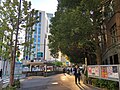
Exit 6, 2019


The station opened on November 18, 1938, as the eastern terminus of the original section of the Tokyo Rapid Railway from Aoyama-Rokuchōme (now Omotesandō). It became a through station when the line was extended to Shimbashi on January 15, 1939.
The station facilities were inherited by Tokyo Metro after the privatization of the Teito Rapid Transit Authority (TRTA) in 2004.[1]
- Kasumigaseki government buildings
- Japan Post HQ
- Willcom HQ
- Japan Tobacco HQ
- Embassy of the United States, Tokyo
- Kasumigaseki Station
- Uchisaiwaicho Station (Toei Mita Line)
- ^ "「営団地下鉄」から「東京メトロ」へ" [From "Teito Rapid Transit Authority" to "Tokyo Metro"]. Tokyo Metro Online. 2006-07-08. Archived from the original on 16 May 2012. Retrieved 29 May 2022.
35°40′13″N 139°45′00″E / 35.670175°N 139.749929°E / 35.670175; 139.749929