Valley View, Sainte Genevieve County, Missouri (original) (raw)
Unincorporated community in Missouri, United States
| Valley View, Missouri | |
|---|---|
| Unincorporated community | |
  Valley View, Missouri Valley View, Missouri |
|
| Coordinates: 38°03′07″N 90°16′32″W / 38.05194°N 90.27556°W / 38.05194; -90.27556 | |
| Country | United States |
| State | Missouri |
| County | Sainte Genevieve |
| Township | Jackson |
| Elevation | 604 ft (184 m) |
| Time zone | UTC-6 (Central (CST)) |
| • Summer (DST) | UTC-5 (CDT) |
| Area code | 573 |
| GNIS feature ID | 735996[1] |
Valley View is an unincorporated community in Jackson Township in Sainte Genevieve County, Missouri, United States. Valley View is located at the junction of Interstate 55 and Supplemental Route DD, 4.3 miles (6.9 km) northwest of Bloomsdale.[2][3]
References
[edit]
- ^ "Valley View". Geographic Names Information System. United States Geological Survey, United States Department of the Interior.
- ^ Ste. Genevieve County General Highway Map (PDF) (Map). Missouri Department of Transportation. 2009. Retrieved May 24, 2012.
- ^ Landmarkhunter.com http://landmarkhunter.com/mo/ste-genevieve/
| vteMunicipalities and communities of Sainte Genevieve County, Missouri, United States | ||
|---|---|---|
| County seat: Ste. Genevieve | ||
| Cities | Bloomsdale Ste. Genevieve St. Mary | 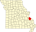 Map of Missouri highlighting Sainte Genevieve County Map of Missouri highlighting Sainte Genevieve County |
| Townships | Beauvais Jackson Ste. Genevieve Saline Union | |
| CDPs | Goose Creek Lake‡ Grayhawk Ozora Weingarten | |
| Other communities | Avon Brickeys Chestnut Ridge Clearwater Clement Coffman Kinsey Lawrenceton Marlo Mill Millers Minnith Mosher Needmore New Offenburg Pickel Quarry Town River aux Vases Rocky Ridge Sprott Thomure Valley View Womack Zell | |
| Ghost towns | La Saline New Bourbon | |
| Footnotes | ‡This populated place also has portions in an adjacent county or counties | |
| Missouri portal United States portal |
 |
This Sainte Genevieve County, Missouri state location article is a stub. You can help Wikipedia by expanding it. |
|---|