Vefsna (original) (raw)
From Wikipedia, the free encyclopedia
River in Norway
| Vefsna (Norwegian)Vaapstenjeanoe (Southern Sami)Vapstälven (Swedish)[1] | |
|---|---|
 The Laksforsen waterfall The Laksforsen waterfall |
|
  Location of the riverShow map of Nordland Location of the riverShow map of Nordland  Vefsna (Norway)Show map of Norway Vefsna (Norway)Show map of Norway |
|
| Location | |
| Country | Norway |
| County | Nordland |
| Region | Helgeland |
| Municipalities | Hattfjelldal, Vefsn, Grane |
| Physical characteristics | |
| Source | Simskardvatnet |
| • location | Hattfjelldal, Nordland, Norway |
| • coordinates | 65°16′59″N 13°48′51″E / 65.28306°N 13.81417°E / 65.28306; 13.81417 |
| • elevation | 877 metres (2,877 ft) |
| Mouth | Vefsnfjord, Mosjøen |
| • location | Vefsn, Nordland, Norway |
| • coordinates | 65°50′09″N 13°11′26″E / 65.83583°N 13.19056°E / 65.83583; 13.19056 |
| • elevation | 0 metres (0 ft) |
| Length | 163 km (101 mi) |
| Basin size | 4,122 km2 (1,592 sq mi) |
| Basin features | |
| Tributaries | |
| • left | Svenningelva |
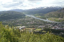
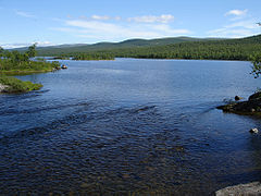
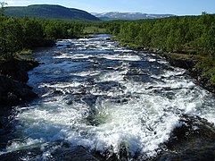
Vefsna (Norwegian), also known as Vaapstenjeanoe (Southern Sami) or Vapstälven (Swedish), is the largest river in Nordland county, Norway. It is 163 kilometres (101 mi) long and drains a watershed of 4,122 square kilometres (1,592 sq mi). Its headwaters lie in the mountains of Børgefjell National Park at the lake Simskardvatnet. The river runs through the municipalities of Hattfjelldal, Grane, and Vefsn. The southern parts of the river are sometimes called the river Susna. The river flows north, not far from the Swedish border, and some of the minor tributaries come from Sweden. At the town of Mosjøen, the river discharges into the Vefsnfjord. The Laksforsen waterfall lies along its course.[2]
Historically, it was an important salmon fishery, but it has now been infected with the salmon parasite Gyrodactylus salaris.[3]
Nordlandsbåter on the Vefsna


- List of rivers in Norway
- ^ "Län och huvudavrinningsområden i Sverige" (PDF) (in Swedish). Swedish Meteorological and Hydrological Institute. Retrieved 14 July 2010.
- ^ Photo of the falls at flood
- ^ Store norske leksikon. "Vefsna" (in Norwegian). Retrieved 2011-11-16.


