Webb County, Texas (original) (raw)
County in Texas, United States
County in Texas
| Webb County | |
|---|---|
| County | |
| County of Webb | |
 Webb County Courthouse in Laredo Webb County Courthouse in Laredo |
|
 Seal Seal |
|
 Interactive map of Webb County Interactive map of Webb County |
|
 Location within the U.S. state of Texas Location within the U.S. state of Texas |
|
| Country |  United States United States |
| State |  Texas Texas |
| Established | January 28, 1848 |
| Organized | March 16, 1848 |
| Named after | James Webb |
| County seat | Laredo |
| Largest city | Laredo |
| Government | |
| • Type | Commissioners Court |
| Area | |
| • Total | 3,375 sq mi (8,740 km2) |
| • Land | 3,361 sq mi (8,700 km2) |
| • Water | 14 sq mi (36 km2) 0.4% |
| Population (2020) | |
| • Total | 267,114 |
| • Density | 79.47/sq mi (30.69/km2) |
| Time zone | UTC−6 (Central) |
| • Summer (DST) | UTC−5 (CDT) |
| Area code | 956 |
| FIPS code | 48479 |
| GNIS feature ID | 1384025 |
| Website | www.webbcountytx.gov |

The Texas tourism travel station is located at the intersection of Interstate 35 and U.S. Route 83 north of Laredo.

Typical Webb County ranch road north of Texas State Highway 359 (2012)
Webb County is a county located in the U.S. state of Texas. As of the 2020 census, its population was 267,114.[1][2] Its county seat and largest city is Laredo.[3] The county was named after James Webb (1792–1856), who served as secretary of the treasury, secretary of state, and attorney general of the Republic of Texas, and later judge of the United States District Court following the admission of Texas to statehood. By area, Webb County is the largest county in South Texas and the sixth-largest in the state. Webb County comprises the Laredo metropolitan area. Webb County is the only county in the United States to border three foreign states or provinces, sharing borders with Coahuila, Nuevo Leon, and Tamaulipas.
Webb County has a minority majority, with 95.2% of the population of the county identifying as Hispanic. This makes Webb the county with the second-highest proportion of Hispanic people in the continental United States after Starr County, and it has the highest proportion of Hispanic people among counties with a population over 100,000.[4]
Webb County was split in 1856. Encinal County was established on February 1, 1856, and was to have consisted of the eastern portion of Webb County. However, Encinal County was never organized and was finally dissolved on March 12, 1899, with its territory returned as part of Webb County.
Much of Webb County history is based on the prevalence of ranching in the 19th century and continuing thereafter. The Webb County Heritage Foundation is a nonprofit organization that seeks to preserve documents and artifacts of the past to guarantee that the regional history is not lost to upcoming generations. In 2015, the foundation, headed by President James E. Moore, presented Heritage Awards to such local notables as the artist Janet Krueger, journalist Maria Eugenia Guerra, and Laredo Community College art instructor Martha F. Fenstermaker (1943-2014).[5]
According to the U.S. Census Bureau, the county has a total area of 3,376 square miles (8,740 km2), of which 3,361 square miles (8,700 km2) are land and 14 square miles (36 km2) (0.4%) are covered by water.[6]
The Webb County–City of Laredo Regional Mobility Authority has responsibility for a comprehensive transport system in the region.
Adjacent counties and municipalities
[edit]
- Dimmit County (north)
- La Salle County (north)
- Duval County (east)
- Jim Hogg County (southeast)
- Zapata County (south)
- Maverick County (northwest)
- McMullen County, Texas (northeast)
- Guerrero, Coahuila, Mexico (west)
- Hidalgo, Coahuila, Mexico (west)
- Anáhuac, Nuevo León, Mexico (west)
- Nuevo Laredo, Tamaulipas, Mexico (south)
- Guerrero, Tamaulipas, Mexico (southwest)
Historical population
| Census | Pop. | Note | %± |
|---|---|---|---|
| 1860 | 1,397 | — | |
| 1870 | 2,615 | 87.2% | |
| 1880 | 5,273 | 101.6% | |
| 1890 | 14,842 | 181.5% | |
| 1900 | 21,851 | 47.2% | |
| 1910 | 22,503 | 3.0% | |
| 1920 | 29,152 | 29.5% | |
| 1930 | 42,128 | 44.5% | |
| 1940 | 45,916 | 9.0% | |
| 1950 | 56,141 | 22.3% | |
| 1960 | 64,791 | 15.4% | |
| 1970 | 72,859 | 12.5% | |
| 1980 | 99,258 | 36.2% | |
| 1990 | 133,239 | 34.2% | |
| 2000 | 193,117 | 44.9% | |
| 2010 | 250,304 | 29.6% | |
| 2020 | 267,114 | 6.7% | |
| U.S. Decennial Census[7]1850–2010[8] 2010[9] 2020[10] |
Webb County, Texas – Racial and ethnic compositionNote: the US Census treats Hispanic/Latino as an ethnic category. This table excludes Latinos from the racial categories and assigns them to a separate category. Hispanics/Latinos may be of any race.
| Race / Ethnicity (NH = Non-Hispanic) | Pop 2000[11] | Pop 2010[9] | Pop 2020[10] | % 2000 | % 2010 | % 2020 |
|---|---|---|---|---|---|---|
| White alone (NH) | 9,508 | 8,345 | 9,495 | 4.92% | 3.33% | 3.55% |
| Black or African American alone (NH) | 294 | 487 | 788 | 0.15% | 0.19% | 0.30% |
| Native American or Alaska Native alone (NH) | 144 | 95 | 135 | 0.07% | 0.04% | 0.05% |
| Asian alone (NH) | 783 | 1,320 | 1,300 | 0.41% | 0.53% | 0.49% |
| Pacific Islander alone (NH) | 16 | 11 | 25 | 0.01% | 0.00% | 0.01% |
| Some other race alone (NH) | 22 | 130 | 458 | 0.01% | 0.05% | 0.17% |
| Mixed race or Multiracial (NH) | 280 | 263 | 559 | 0.14% | 0.11% | 0.21% |
| Hispanic or Latino (any race) | 182,070 | 239,653 | 254,354 | 94.28% | 95.74% | 95.22% |
| Total | 193,117 | 250,304 | 267,114 | 100.00% | 100.00% | 100.00% |
As of the 2015 Texas Population Estimate Program, the population of the county was 273,536. The racial makeup of the county was 99.8% White and 0.2% Black or African American. The ethnic makeup of the county was non-Hispanic whites 8,699 (3.2%), Black Americans 552 (0.2%), and other non-Hispanic 2,134 (0.8%). Hispanics and Latinos (of any race) 262,151 (95.8%).[12]
As of the census[13] of 2000, 193,117 people, 50,740 households, and 43,433 families resided in the county. The county gained 57,000 additional residents between 2000 and 2010. The population density was 58 people/sq mi (22/km2). The 55,206 housing units averaged 16/sq mi (6/km2). The racial makeup of the county was 82.16% White, 0.37% Black or African American, 0.47% Native American, 0.43% Asian, 14.02% from other races, and 2.54% from two or more races. About 94% of the population was Hispanic or Latino of any race.
Of the 50,740 households, 53.20% had children under 18 living with them, 62.60% were married couples living together, 18.30% had a female householder with no husband present, and 14.40% were not families; 12.40% of all households were made up of individuals, and 5.10% had someone living alone who was 65 years of age or older. The average household size was 3.75, and the average family size was 4.10.
In the county, the age distribution was 36.20% under 18, 11.40% from 18 to 24, 29.30% from 25 to 44, 15.60% from 45 to 64, and 7.60% who were 65 or older. The median age was 26 years. For every 100 females, there were 92.90 males. For every 100 females age 18 and over, there were 87.90 males.
The median income for a household in the county was 28,100,andforafamilywas28,100, and for a family was 28,100,andforafamilywas29,394. Males had a median income of 23,618versus23,618 versus 23,618versus19,018 for females. The per capita income for the county was $10,759. About 26.70% of families and 31.20% of the population were below the poverty line, including 39.40% of those under age 18 and 26.90% of those age 65 or over.
Webb County was a longtime Democratic stronghold.[16] However, since 2016, Webb County has been trending more towards the Republican Party due to Donald Trump attracting more Hispanic voters. This mirrors the same trend seen in other counties in South Texas. In 2024, the county flipped Republican by a slim majority, the first time it had done so since 1912. Webb was Biden's best county in 2020 of the counties that flipped to Trump in 2024 by margin; the county went from voting for Biden by 23% to voting for Trump by 2%. Overall, Webb County shifted to the right from 2012 to 2024 by 56 percentage points, representing one of the strongest such rightward shifts for any county in the country.[17]
Three school districts serve Webb County:[18]
- Laredo Independent School District
- United Independent School District
- Webb Consolidated Independent School District
Prior to 1994, Webb CISD served only Bruni and Oilton. Mirando City Independent School District served the community of Mirando City from 1923 to 2005. Prior to 1994, all Mirando City children attended Mirando City ISD schools. After the spring of 1994, Mirando City High School closed.[19] Therefore, from the fall of 1994 to July 1, 2005, WCISD served high schoolers from Mirando City, while Mirando Elementary School in the Mirando City ISD served pupils from kindergarten through eighth grade. On May 9, 2005, the Texas Education Agency ordered the closure of Mirando City ISD. The district closed on July 1, 2005, and all students were rezoned to Webb CISD schools.[20]
The private Holding Institute is a former United Methodist boarding school operating as a downtown Laredo community center.
All residents are zoned to Laredo College.[21]
Census-designated places
[edit]
- Aguilares
- Bonanza Hills
- Botines
- Bruni
- Colorado Acres
- Four Points
- Hillside Acres
- La Coma
- La Moca Ranch
- La Presa
- Laredo Ranchettes
- Laredo Ranchettes West
- Las Haciendas
- Las Pilas
- Los Altos
- Los Arcos
- Los Centenarios
- Los Corralitos
- Los Fresnos
- Los Huisaches
- Los Minerales
- Los Nopalitos
- Los Veteranos I
- Los Veteranos II
- Mirando City
- Oilton
- Pueblo East
- Pueblo Nuevo
- Ranchitos East
- Ranchitos Las Lomas
- Ranchos Penitas West
- San Carlos I
- San Carlos II
- Sunset Acres
- Tanquecitos South Acres
- Tanquecitos South Acres II
- Valle Verde
Former census designated places
[edit]
Other unincorporated communities
[edit]
- Callaghan
- Las Tiendas
- Webb
- Darwin
- Islitas
- Los Ojuelos
- Pescadito
- Santo Tomas
- Talise[22]

Map of Webb and Encinal Counties in 1895
Webb County Courthouse in 1905
Webb County Courthouse today- [
 ](/wiki/File:Webb%5FCounty,%5FTX%5Fcourthouse%5Fannex%5FIMG%5F1780.JPG "Entrance to the William N. "Billy" Hall Administrative Building annex of the Webb County Courthouse in Laredo")
Entrance to the William N. "Billy" Hall Administrative Building annex of the Webb County Courthouse in Laredo 
The Webb County Appraisal District Office in Laredo appraises taxable real property for municipal and county governments, Laredo Community College, and both public school districts.
Entrance to the J. O. Walker, Jr., Piedra Parada Ranch in eastern Webb County
Opuntia cacti abound throughout much of Webb County.
The Cactus Jack Ranch in northwestern Webb County is named for U.S. President Franklin D. Roosevelt's first vice president, John Nance Garner of Uvalde. Imported saguaro cacti are planted at the gate.
Entrance gate to La Esperanza (Hope) Ranch in northwestern Webb County near the Dimmit County boundary
This abandoned building along U.S. Route 83 in northwestern Webb County reflects the isolation of the South Texas ranch country.
Road through Tamaulipan thornscrub, Webb County, Texas, USA (10 June 2016)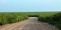
Road through Tamaulipan thornscrub, Webb County, Texas, USA (10 June 2016)- List of museums in South Texas
- National Register of Historic Places listings in Webb County, Texas
- Recorded Texas Historic Landmarks in Webb County
- Webb County Courthouse


- ^ 2020 Population and Housing State Data | Arizona
- ^ "Webb County, Texas". United States Census Bureau. Retrieved February 23, 2021.
- ^ "Find a County". National Association of Counties. Archived from the original on May 31, 2011. Retrieved June 7, 2011.
- ^ "P2: HISPANIC OR LATINO, AND NOT HISPANIC OR LATINO BY RACE". 2020 Census. United States Census Bureau. Retrieved October 10, 2021.
- ^ Gabriel A. Trevino, "Preservation of history", Laredo Morning Times, May 24, 2015, pp. 1, 17A
- ^ "2010 Census Gazetteer Files". United States Census Bureau. August 22, 2012. Archived from the original on April 19, 2015. Retrieved May 12, 2015.
- ^ "Decennial Census of Population and Housing by Decade". US Census Bureau.
- ^ "Texas Almanac: Population History of Counties from 1850–2010" (PDF). Texas Almanac. Archived (PDF) from the original on February 26, 2015. Retrieved May 12, 2015.
- ^ a b "P2: Hispanic or Latino, and Not Hispanic or Latino by Race – 2010: DEC Redistricting Data (PL 94-171) – Webb County, Texas". United States Census Bureau. Retrieved January 26, 2024.
- ^ a b "P2: Hispanic or Latino, and Not Hispanic or Latino by Race – 2020: DEC Redistricting Data (PL 94-171) – Webb County, Texas". United States Census Bureau. Retrieved January 26, 2024.
- ^ "P004: Hispanic or Latino, and Not Hispanic or Latino by Race – 2000: DEC Summary File 1 – Webb County, Texas". United States Census Bureau. Retrieved January 26, 2024.
- ^ Estimates of the Population by Age, Sex, and Race/Ethnicity for July 1, 2015 for State of Texas (PDF), July 15, 2015, archived (PDF) from the original on May 4, 2017, retrieved June 8, 2017
- ^ "U.S. Census website". United States Census Bureau. Retrieved May 14, 2011.
- ^ Leip, David. "Dave Leip's Atlas of U.S. Presidential Elections". uselectionatlas.org. Archived from the original on March 23, 2018. Retrieved May 6, 2018.
- ^ "2024 Senate Election (Official Returns)". Commonwealth of Texas by county. November 5, 2024. Retrieved December 5, 2024.
- ^ "2014 Democratic and Republican Party Primary Election Returns for Webb County". Texas Secretary of State. Archived from the original on March 20, 2014. Retrieved March 20, 2014.
- ^ Goldmacher, Shane (May 25, 2025). "How Donald Trump Has Remade America's Political Landscape". The New York Times. Archived from the original on May 27, 2025. Retrieved May 29, 2025.
- ^ "2020 CENSUS - SCHOOL DISTRICT REFERENCE MAP: Webb County, TX" (PDF). U.S. Census Bureau. Archived (PDF) from the original on October 9, 2022. Retrieved June 29, 2022. - list
- ^ Mirando City, Texas from the Handbook of Texas Online
- ^ Bogan, Jesse. "A school district counts its final days." San Antonio Express-News. May 9, 2005. 01A. Retrieved on April 11, 2009.
- ^ Texas Education Code Sec. 130.185. LAREDO COMMUNITY COLLEGE DISTRICT SERVICE AREA.
- ^ Garza, Lisely (May 16, 2024). "Talise, a new self-sufficient town, begins development". kgns.tv. Retrieved October 4, 2025.
- Lambert, R.B. (2004). Hydrogeology of Webb County, Texas [Scientific Investigations Report 2004-5022]. Reston, VA: U.S. Department of the Interior, U.S. Geological Survey.
- Webb County government's website
- Webb County in Handbook of Texas Online at the University of Texas
- Webb County Heritage Foundation