Wirini (original) (raw)
Place in Highland Papua, Indonesia
| Wirini | |
|---|---|
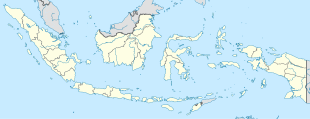
  WiriniLocation in Western New Guinea and IndonesiaShow map of Western New Guinea WiriniLocation in Western New Guinea and IndonesiaShow map of Western New Guinea  WiriniWirini (Indonesia)Show map of Indonesia WiriniWirini (Indonesia)Show map of Indonesia |
|
| Coordinates: 3°49′46.9092″S 138°24′47.4336″E / 3.829697000°S 138.413176000°E / -3.829697000; 138.413176000 | |
| Country |  Indonesia Indonesia |
| Province | Highland Papua |
| Regency | Lanny Jaya Regency |
| District | Pirime District |
| Elevation | 12,277 ft (3,742 m) |
| Population (2010) | |
| • Total | 855[1] |
| Time zone | UTC+9 (Indonesia Eastern Standard Time) |
Wirini is a village in Pirime district, Lanny Jaya Regency in Highland Papua province, Indonesia. Its population is 855.[1]: 2136
Wirini has a wet tundra climate (ET) with heavy rainfall year-round.
| Climate data for Wirini | |||||||||||||
|---|---|---|---|---|---|---|---|---|---|---|---|---|---|
| Month | Jan | Feb | Mar | Apr | May | Jun | Jul | Aug | Sep | Oct | Nov | Dec | Year |
| Mean daily maximum °C (°F) | 15.4(59.7) | 15.3(59.5) | 14.7(58.5) | 14.1(57.4) | 13.3(55.9) | 12.2(54.0) | 11.4(52.5) | 11.3(52.3) | 12.7(54.9) | 14.5(58.1) | 15.1(59.2) | 15.3(59.5) | 13.8(56.8) |
| Daily mean °C (°F) | 9.3(48.7) | 9.3(48.7) | 9.2(48.6) | 8.8(47.8) | 8.5(47.3) | 7.7(45.9) | 7.2(45.0) | 7.0(44.6) | 7.6(45.7) | 8.6(47.5) | 8.8(47.8) | 9.3(48.7) | 8.4(47.2) |
| Mean daily minimum °C (°F) | 3.3(37.9) | 3.4(38.1) | 3.8(38.8) | 3.6(38.5) | 3.7(38.7) | 3.3(37.9) | 3.1(37.6) | 2.7(36.9) | 2.5(36.5) | 2.7(36.9) | 2.5(36.5) | 3.3(37.9) | 3.2(37.7) |
| Average precipitation mm (inches) | 322(12.7) | 344(13.5) | 322(12.7) | 303(11.9) | 301(11.9) | 298(11.7) | 305(12.0) | 287(11.3) | 280(11.0) | 307(12.1) | 283(11.1) | 312(12.3) | 3,664(144.2) |
| Source: Climate-Data.org[2] |
- ^ a b "Population of Indonesia by Village: Result of 2010 Population Census" (PDF). Statistics Indonesia. Archived from the original (PDF) on 6 April 2013. Retrieved 2020-07-23.
- ^ "Climate: Wirini". Climate-Data.org. Retrieved July 25, 2020.