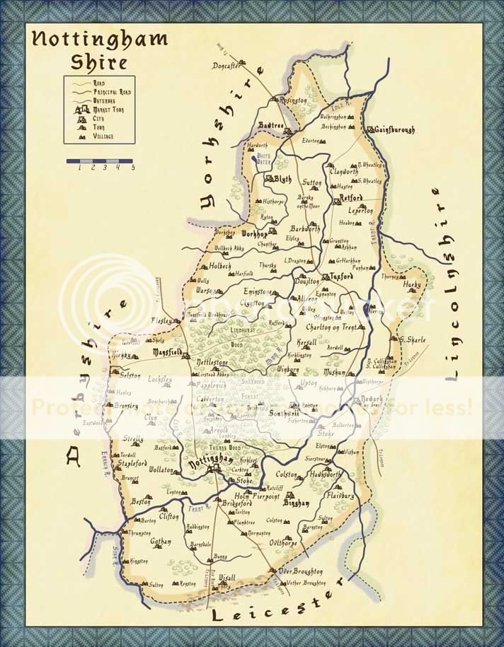
Map of Nottinghamshire (original) (raw)
This is our official map so that players have the option of using realistic travel and to help them better visualize the setting. We have also created a table of common travel routes to make judging travel times even easier.
Click the picture to be taken to the larger, HQ image.
All distances on this chart are proximate and are based off of our map, not 'real life'. "From" and "To" can obviously be switched, the distance is the same regardless of which direction you are going. "By Road" means that it was measured using the most direct route by road, though it often includes at least a small amount of off-road travel. "Overland" is measured in a straight line between the destinations and does not account for terrain or other obstacles. If you need to know another distance or the exact distance between points according to our map, please feel free to ask 
| From | To | By Road | Overland |
|---|---|---|---|
| Nottingham | Locksley | 9.5 | 7.6 |
| Nottingham | Clun | 7.7 | 6.1 |
| Nottingham | Taversall | 15.3 | 12 |
| Nottingham | Nettlestone | 10.5 | 7.8 |
| Nottingham | Knighton | 6.5 | 4.3 |
| Locksley | Clun | 8.5 | 3.3 |
| Locksley | Taversall | 5.3 | 4.5 |
| Locksley | Nettlestone | 5.2 | 4 |
Some speeds for judging travel times:
Walkin 3-4mph
Horse Trot 8-10mph
Horse Canter/lope 10-17mph
Horse Gallop 30mph, depending on breed/build/etc
Thanks to:
Our wonderful players for their encouragement, advice, and proofreading
British-genealogy.com for putting up this historical map of Nottingham, which much of our map is based on.


StarRaven, for the cartography symbols