GENUKI: Staveley, Westmorland (original) (raw)
Hide

Hide
_"_Staveley and Hugill... Having now advanced to the furthest extremity of the parish towards the north-west, we turn southwards to Staveley and Hugill. Staveley and Hugill are bounded on the east by Long Sleddale, being divided therefrom by the ridge of Potter Fell; on the south by Underbarrow, being divided by the top of Ratherhead; on the west by Crook, being divided by the ridge of Brackenthwait Fell; and on the north by Kentmere, being divided by Blackbeck which runs by Milrigg. The chapel of Staveley is a fair building, with a handsome steeple and three good bells. To what saint it was dedicated is not certain: From the inscription on one of the bells, it seems to have been St. Margaret. Staveley and Hugill were originally one chapelry. But afterwards a separate chapel was erected at Ings in Hugill, so called from a long Ing or watery meadow, at the head of which it stands. As Grasgarth there was anciently a chapel called St. Anne's, about a quarter of a mile north-west from the present chapel of Ings."
[Nicolson and Burn: The history and antiquities of the counties of Westmorland and Cumberland. 1777. Transcribed by Anne Nichols.]
Hide
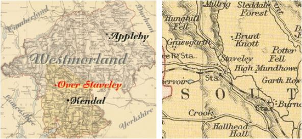
Staveley (or Over Staveley) is a parish in Kendal Ward. It was formerly in Kendal parish.
The parishes of Hugill, Kentmere, Long Sleddale, Burnside and Crook are nearby.