Climbing, Hiking & Mountaineering : SummitPost (original) (raw)
Overview
The Breithorn range
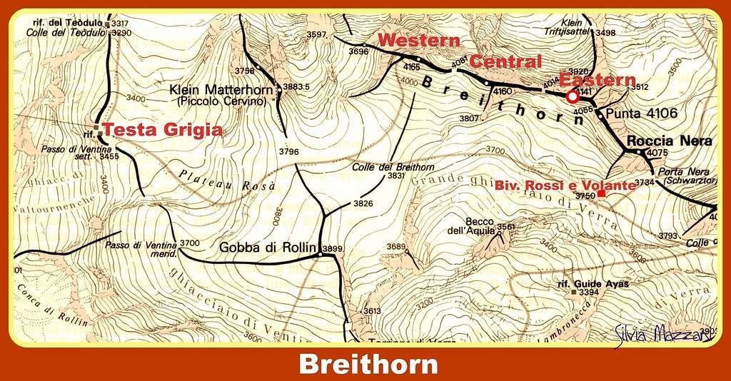
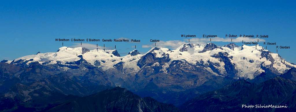
The Breithorn range stretches aligned West-East along the border ridge between Italy and Switzerland for about 2.5 kilometers. It is not a single peak, but it's actually made up of five peaks connected by a thin and long ridge wire which makes up the Western end of the still more massive frontier crest stretching from Monte Rosa, over the multiple summits of the Liskamm Group, and past the twin peaks of Castor and Pollux. Starting from the west and going east we meet at first the Breithorn Occidentale (4165 meters, 13,665 feet), which is the highest summit, the Breithorn Centrale (4160 m, 13,648 feet), the Breithorn Orientale (4141 m, 13,586 feet), the Breithornzwillinge or Gemelli del Breithorn or Punta 4106 (4106 m, 13,471 feet) and the Roccia Nera (4075 m, 13,369 feet). All summits are in the list of the UIAA. Check here the complete list of the 82 alpine Fourthousanders and the 46 minor summits: Club4000.
The Breithorn Occidentale is separated from the Breithorn Centrale by the Sella 4081 m. Between the Breithorn Centrale and the Breithorn Orientale we find the Finestra del Breithorn 4014 m. After the Roccia Nera it follows the Porta Nera 3734 m (Schwarztor in German), which separates the Breithorn range from the Pollux, where the Breithorn chain ends.
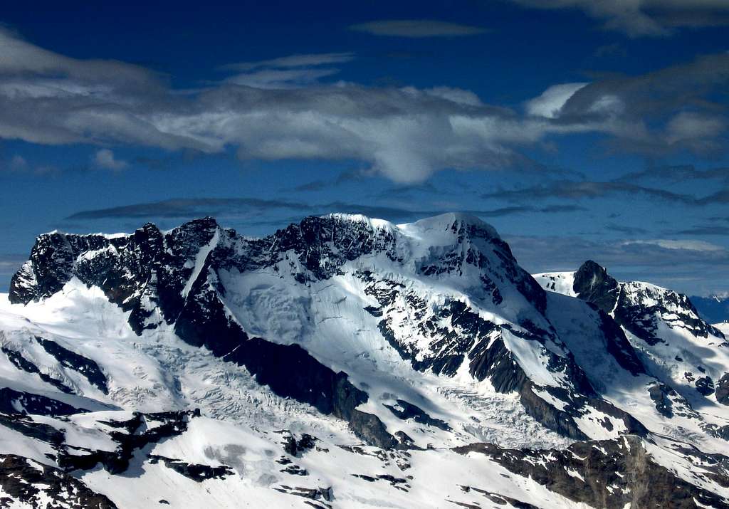
Breithorn chain seen from the North
If it were not for the Klein Matterhorn cable car, which whisks climbers and skiers up to over 3800 meters, the Breithorn would be a long climb by any route. But the lift has turned the SSW Flank route on the Breithorn Occidentale, which is the closest summit to the cableway arrival station, into one of the most climbed 4000 meter peaks of the Alps. This is a snow and glacier route and the most attended itinerary of the entire Breithorn chain. The primary challenges are those ones usually associated with high altitude climbing, that is fitness, pace and basic crampon technique. In poor weather, or when avalanche hazard exists on this side of the peak, the climb takes on another character. Most of the time, however, this route offers an enjoyable outing with incredible views and a rewarding summit.
Breithorn
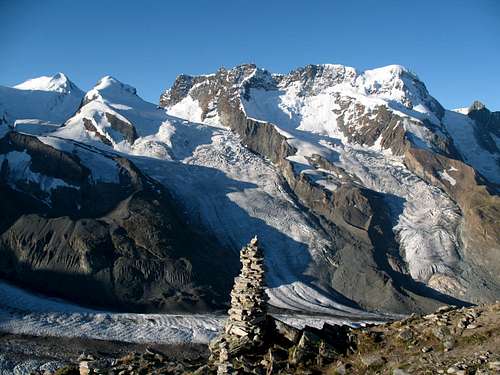
VIEW FROM THE HÖRNLIHÜTTE TOWARDS MONTE ROSA & BREITHORN
Getting There
ITALIAN SIDE: CERVINIA
Breuil-Cervinia Valtournenche is situated in the Aosta Valley, in the north-west of Italy. Easy to reach, it is served by the motorway A5 Torino-Aosta. Exit Chatillon - St Vincent turn off and continue along the regional road towards Cervinia for 27 km. Valtournenche is 7 km before Breuil-Cervinia and 21 km from Chatillon.
Transfers are also easy thanks to the proximity of the national airports of Torino Caselle (118 km), Milano Malpensa
(160 km), Milano Linate (180 km) and the international airports of Frankfurt, Paris, Zurich and Geneva.
SWISS SIDE: ZERMATT
Located in southern Switzerland at an altitude of 1,600 metresand just a few hours from the international airport of Zurich, Generva and Milano. Zermatt easily accessible from western, northern or southern Europe.
International rail connections link up to Brig with the modern narrow-gauge Zermatt railway, which takes only 90 minutes to climb through the Visp Valley.
Motorists can drive as far as Täsch, from where trains (shuttle trains run every 20 minutes) and minibus taxi operate a shuttle service for the remaining 4.8 km/3 miles to Zermatt. Low cost parking are available in Täsch, as well as in Visp.
The Breithorn summits
The Breithorn range has five summits. All summits are in the list of the UIAA.
The parade of Monte Rosa 4000s
Breithorn Occidentale - Western Breithorn (4165 m, 13,665 feet), the highest summit and the Westernmost
Breithorn Centrale - Central Breithorn (4160 m, 13,648 feet),
Breithorn Orientale - Eastern Breithorn (4141 m, 13,586 feet),
Breithornzwillinge or Gemelli del Breithorn or Punta 4106 (4106 m, 13,471 feet)
Roccia Nera (Schwarzfluh 4075 m, 13,369 feet), the lowest summit and the Easternmost
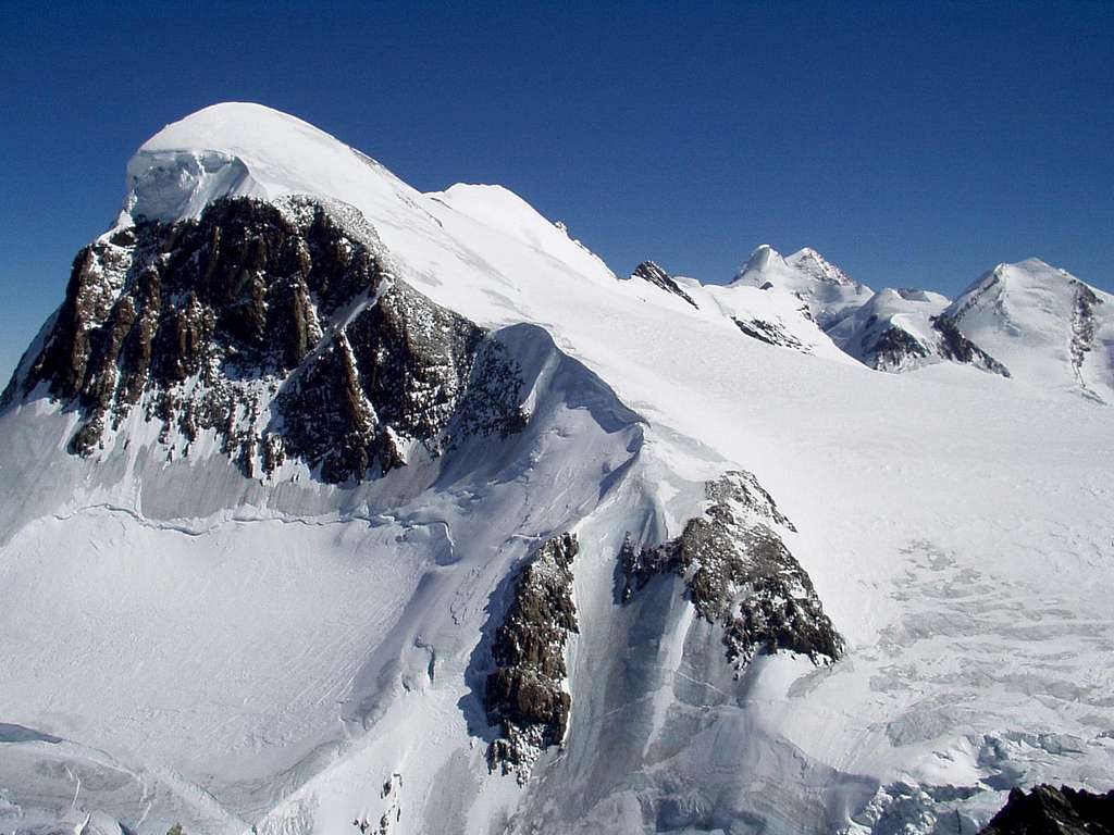
View from the main summit towards Mischabel
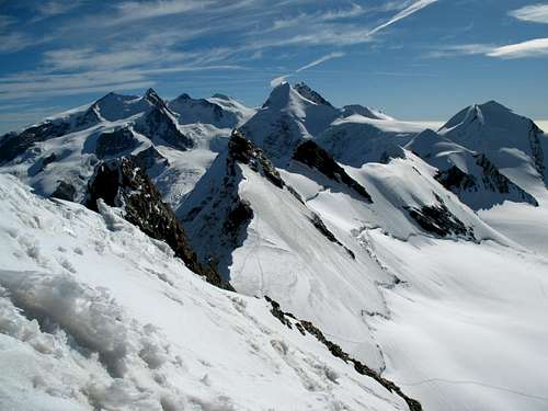
View from the Central Breithorn towards Monte Rosa
BREITHORN WEST
The normal route, the SSW Flank, is an easy climb on 35 degree snow or ice. It is accessible by cable car, and therefore makes an enjoyable day climb for training and acclimatization. It also affords incredible views.
The north face of this mountain - 1700 m high - is by contrast rather impressing and the ascent is rated AD like Matterhorn.
BREITHORN CENTRAL AND EAST
The Half Traverse of the Breithorn Crest is almost 3 kilometers in length. The climber normally gain the crest at about the halfway point at col 4022m. From here you have to climb over the 3 main rocky steps, very exposed but never extreme. The traverse ends with an easy corniced ridge to to highest summit at the west end.
The crossing of the Breithorn is a profitable ride at high altitude that allows climbing 5 peaks over 4000 meters
ROCCIA NERA (Schwarzfluh)
You can climb this summit from Bivacco Rossi e Volante
First Ascents
West Breithorn: 13 August 1813, by H. Mainard, J.M.Coutet, J.Gras, J.B. and J.J. Erin
Central Breithorn: 19 July 1900 by E. Hahn
East Breithorn: 16 August 1884 by J.Stafford Anderson
Huts
The refuge
Situation: Ghiacciaio di Verra
Owner: C.A.I. Torino
Open: summer
Size: 36 persons
Winter shelter: 20 persons
Phone: 0039-0125-307226
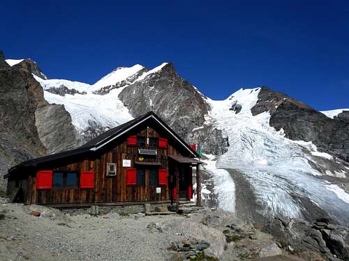
From Champoluc, fraction St. Jacques, reach Blanchard hamlet and then take the path CAI n. 7. After a small bridge, the trail leads through the woods, passes a clearing in the woods and into the wood again until converging with the dirt road (closed to vehicles) coming from Saint-Jacques. Cross the Pian di Verra Inferiore, after which the signposts indicate the Blue Lake and on the right Rifugio Mezzalama and Rifugio Guide Val d'Ayas. After crossing the bridge, we follow the path which cuts the curves of the road then along the river we enter a valley that leads to the Upper Pian di Verra. Shortly before, indicated by two signs, the trail branches off to the left and up the steep slope that forms the other side of the moraine of the glacier. The trail passes along the edge of the moraine in sight of Refuge Mezzalama, then it appears also the higher Rifugio Guide Val d'Ayas. Yet following the moraine reach the Refuge Ottorino Mezzalama 3004 m.
The refuge
Situation: Lambronecca
Guardian: Guide di Champoluc e Val d'Ayas
Open: from July to September
Size: 85 persons
Winter shelter: 16 persons
Phone: 0039-346441219
Rifugio Teodulo
Situation: above Theodulgletscher and Theoduljoch just some meters on Italian ground; 45°56′39″N 7°42′30″E Valtournenche Valle d'Aosta
Owner: CAI sezione di Torino
Open: all year round
Size: 86 persons
Winter shelter: hut is open in winter
Phone: 0039-0166-949400
Rifugio Teodulo is situated about 1 hour above Gandegghütte. If you approach the hut from the Swiss side follow the route to Gandegghütte. Climb the rock ridge / middle moraine south of Gandegghütte and follow the ridge and right / west of it until you reach the Theodulgletscher. Follow Gandegg ski lift track until you arrive below Theodul col. Go right and ascend steeply to the col. Some more steps bring you up to Rifugio Teodulo.
The approach from the italian side starts at Breuil-Cervinia and uses the cable cars os the trails and mountain roads via Plan Maison to Colle Teodulo and the mountain hut.
Rifugio Guide del Cervino
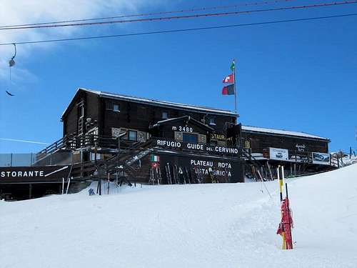
- Rifugio Guide del Cervino m. 3480 – (Testa Grigia) Breuil-Cervinia upper Cable car station
Bivouac Rossi e Volante
- Bivacco Rossi e Volante 3750 m
Situation: Verra Glacier near Porta Nera
Opening: permanent
Owner: Club Alpino Italiano Sez. Torino
Size: 10 persons
Access: From the Rifugio Guide Valle d'Ayas to Lambronecca with about 1.30-2 hours on the glacier (difficulty F)- required rope, ice ax and crampons
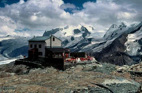
View from the Gandegg Hut
Situation: below Theodulgletscher
Owner: private: Richi & Yvette Lehner-Gaudin
Open: all year round
Size: 45 persons
Winter shelter: hut is open in winter
Phone: 0041-(0)79-607 88 68
Access: From Zermatt railway station follow Bahnhofstraße and Oberdorfstraße to the cable car station Zermatt – Furi. Stay right and follow the trail, direction Zmutt (signposts for Gandegghütte) until you can cross the Zmutt creek on a foot bridge left of that trail (again signposts Gandegghütte). Ascend to the Alp village “Zum See” and to “Hermetji". After Hermetji inn a trail branches off to the left in the direction to Furgg. Cross the ski run below Furgg and follow the trail, marked again Gandegghütte. Beautiful view of Matterhorn. The trail climbs the moderate grade slopes up to cable car station Trockener Steg. At a trail junction go straight on (to the right you will reach Trockener Steg), pass by a small lake and arrive at Gandegghütt
Trofeo Mezzalama
Mezzalama trophy is an amazing ski-alpin competition aroun several Monte Rosa peaks.
Meteo and Mountain condition
Meteo Regione Valle d'Aosta
Meteo Switzerland
Meteo Cervinia
Meteo Zermatt
Guidebooks and maps
Guidebooks
"Il grande libro dei 4000" by Marco Romelli, Valentino Cividini - Idea Montagna Editore, 2015
“Monte Rosa” by Gino Buscaini (Club Alpino Accademico Italiano) – Collana Guide dei Monti d'Italia CAI-TCI (Club Alpino Italiano-Touring Club Italiano)
“Tutti i 4000” – L’aria sottile dell’alta quota” – CLUB 4000 CAI TORINO – Vivalda Editori
“The 4000 of the Alps” by Richard Goedeke (CAAI) – All the normal routes to the 4000m. summits of the Alps – Libris Edition
"Le Alpi Pennine, le 100 più belle ascensioni fra il Gran San Bernardo e il Sempione” by Michel Vaucher - Zanichelli Editore“
“I Quattromila delle Alpi” by Karl Blodig and Helmut Dumler – Zanichelli Editore
“100 scalate su ghiaccio e misto” by Walter Pause – Gorlich Editore
"Hochtouren im Wallis - Vom Trient zum Nufenenpass" by Hermann Biner 2nd ed. 1996
"Viertausender der Alpen" by Helmut Dumler and Willi P. Burkhardt 11th ed. Munich 1998
"Walliser Alpen. DAV-Gebietsführer" by Michael Waeber 12th ed. Munich 1999
"Valliser Alpen. Die 100 schönsten Touren" by Michel Vaucher 2nd ed. Munich 1990
Maps
Cervino-Matterhorn and Monte Rosa map
"Breuil/Cervinia-Zermatt" Kompass map 1:50.000
"Cervino-Matterhorn e Monte Rosa" n. 5 - Istituto Geografico Centrale map 1:50.000
Schweizer Landeskarten:
"Zermatt" n. 1348 1:25000
"Matterhorn-Mischabel" n. 5006 1:50000
"Mischabel" n. 284 1:50000
"Gressoney" n. 294 1:50000
