The Pacific War Online Encyclopedia: Mountains (original) (raw)
|  The Pacific War Online Encyclopedia | |
| -------------------------------------------------------------------------------- | |
The Pacific War Online Encyclopedia | |
| -------------------------------------------------------------------------------- | |
U.S. Army. Via ibiblio.org
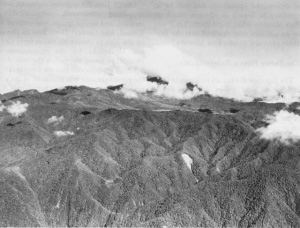
Mountains have always been a formidable obstacle to military operations. The rugged terraingreatly hinders movement of any kind and provides excellent cover for defenders. The high peaks provide numerous observation points for artillery.
Whenever possible, attacking forces avoided driving through mountainous areas. Thus, both the Allies and the Japanese landed at Lingayen Gulf for their offensives against Manila, so that their drive would develop over the relatively flat ground between Lingayen and the city. However, the Allies in 1941 retreatedinto the mountainous Bataan Peninsulaand held out for several months, while the Japanese in 1945 retreated into the mountains on either side of the central Luzonplain and were still resisting at the time of the surrender.
The Japanese offensive in Malaya was largely shaped by the terrain of the region, which included a mountainous spine down the center of the peninsula. The Japanese landed in southernmost Thailand and crossed the peninsula to the southwest coast, where there was flat ground in the rain shadow of the mountains.
The early campaign in New Guinea involved operations across the Owen Stanley Mountains, and the Japanese suffered disaster when their logistics collapsed. The Allies relied heavily on air transport to sustain their counteroffensive, and both sides made use of coastal barges.
The Himalayaswere a militarily insurmountable obstacle to land operations. However, the Allies established an air bridge over the mountains to bring supplies into China. The Burma campaign was fought largely to secure the only land route to China across the southern Himalayas.
Japan itself is a mountainous country. Had the Allies felt compelled to invade the home islands, the initial landings on Kyushu would have been pressed only far enough to establish a base for further operations. The second phase of the invasion would have been directed against the Kanto Plain around Tokyo, one of the few large areas of flat ground in Japan. The Allies correctly guessed that there were plans to move the Emperorand the government to strongholdsin the interior mountains of Honshu, which would have been very costly to isolate and reduce.
Because of the nature of the geological forces involved, nonvolcanic mountainous areas tend to lie in parallel ridges that give a "grain" to the terrain. Movement along the grain (parallel to the ridges), while still difficult, is considerably easier than movement across the grain of the terrain. Thus, during the battle of Imphal, 33 Division approaching from the south was able to move more rapidly than 15 Division approaching from the east, because 33 Division was moving with the grain of the terrain while 15 Division was forced to move across the grain.
Motorized forces, particularly tanks, were of limited use in mountainous terrain. In addition to supply by air drop, supplies were brought in by indigenous porters hired or impressed for this purpose, or by pack animals such as mules. Artillery was typically limited to mortars or special mountain artillery of limited caliber. Mountainous terrain was particularly favorable for the use of mortars, with their high trajectories. Temperatures in the highest mountains could drop below freezing even in the tropics, and frostbite and hypothermia were real risks during the Kokoda campaign in the Owen Stanley Mountains. Soldiers had to acclimatize to the thin air or risk altitude sickness: At 9,000 feet, the oxygen pressure is only about 72% of that at sea level.
References
The Pacific War Online Encyclopedia © 2008 by Kent G. Budge. Index
