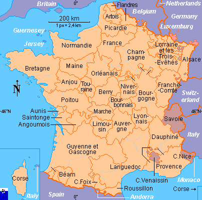
Clickable map of France (traditional provinces) (original) (raw)

This page is part of © FOTW Flags Of The World website
Last modified: 2013-12-07 by antónio martins
Keywords: [(no keywords)](keyword%28.html#%28no keywords%29) |
Links: FOTW homepage |search | disclaimer and copyright | write us | mirrors
- Clickable map of France (traditional provinces) See also:
- France: Historical Provinces
- France
- Clickable map of France (departments)
- Clickable map of France (regions)
- Clickable map of Europe
 |
  France as of 1789 France as of 1789  France after 1945 France after 1945  Current regional borders Current regional borders |
|---|
Copyright: FOTW France provinces map by Pierre Gay and António Martins(based i.a. on material from Petit Larousse Illustré) and boundaries’ data by**Jarig Bakker,Phil Nelson** and**António Martins**. If you wish to reuse them on your website, read our copyright rules.
Anything below this line was not added by the editor of this page.