Clickable map of Portugal (traditional provinces) (original) (raw)

This page is part of © FOTW Flags Of The World website
Last modified: 2014-06-29 by klaus-michael schneider
Keywords: [(no keywords)](keyword%28.html#%28no keywords%29) |
Links: FOTW homepage |search | disclaimer and copyright | write us | mirrors
- Clickable map of Portugal (traditional provinces) See also:
- Portugal
- Subdivisions of Portugal: traditional provinces
- Clickable map of Portugal (districts)
- Clickable map of Portugal (1999 ref. adm. regions)
- Clickable map of Portugal (C.C.R.s / NUT2)
- Clickable map of Europe
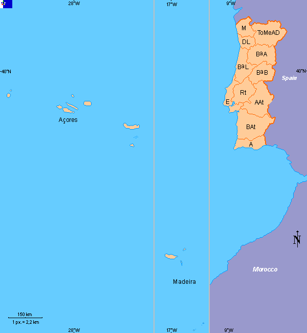 |
Traditional Provinces: A Algarve AAt Alto Alentejo BAt Baixo Alentejo BªA Beira Alta BªB Beira Baixa BªL Beira Litoral DL Douro Litoral E Estremadura M Minho ToMeAD Trás-os-Montes e Alto Douro Açores Madeira |
|---|
Copyright: FOTW Portugal map and boundaries’ data by**António Martins**. If you wish to reuse them on your website, read our copyright rules.
Anything below this line was not added by the editor of this page.