The Encyclopedia of Arda - Waymeet (original) (raw)
A township on the East Road

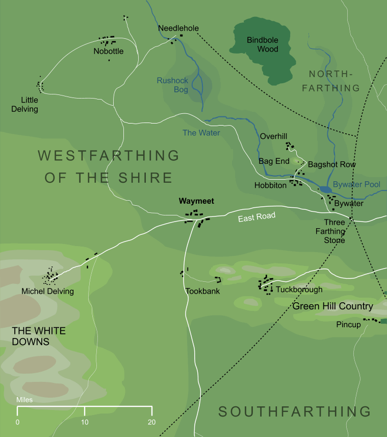
A traveller journeying east from Michel Delving would pass along the main East Road through the Shire. While still in the Westfarthing, this was met by two smaller roads: one from Little Delving to the north, and one from Tookland and the Southfarthing beyond. Where these roadways came together, a town had grown up, appropriately known as Waymeet.
In the War of the Ring, the ruffians who took over the Shire had a staging post or barracks in Waymeet, and it was from here that Sharkey's Men set out for the Battle of Bywater, in which they were soundly defeated by the Shire-hobbits.
The name Waymeet is a modernised spelling of a name with another older form, Waymoot, which is the spelling preferred by Tolkien in early drafts of The Return of the King. Though he ultimately modernised the name within the book itself, the map of the Shire that accompanies The Lord of the Rings was never corrected, and still carries the older spelling of the name.
Notes
| 1 | Waymeet takes its name from the fact that it stood at the meeting point of three important roads. The busiest of these was the East Road itself, which ran eastward through the Shire and on into Eriador. To the west, the same road led to Michel Delving, and on to the southern part of the White Downs. Another road ran southward from Waymeet to Sarn Ford on the Shire's southern border, and from there into Minhiriath and beyond. A third way led west and a little north, leading eventually to Little Delving on the northern White Downs. |
|---|
Indexes:
About this entry:
- Updated 4 October 2021
- This entry is complete
For acknowledgements and references, see the Disclaimer & Bibliography page.
Original content © copyright Mark Fisher 2004, 2010, 2021. All rights reserved. For conditions of reuse, see the Site FAQ.