Louisiana Base and Elevation Maps (original) (raw)


The two maps shown here are digital base and elevation maps of Louisiana. Higher resolution maps like these and many other digital maps, wall maps, custom radius maps, travel maps, travel guides, map software, and globes and games, for business and the classroom, are available to purchase fromMaps.com - The World's Largest Maps Store!.Enter code "NETSTATE" at checkout for 10% off orders of $50 or more!
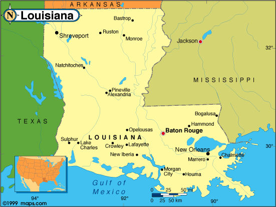 |
This Louisiana base map highlights the location of the state capitol,Baton Rouge, and othter major cities throughout the state. Portions of Louisiana's border states,Arkansas,Mississippi, andTexas are included to show the relationship between Louisiana and its neighbors. A small inset shows Louisiana among the other 47 Continental United States. |
|---|---|
| Louisiana base map, Courtesy of Maps.com. |
|
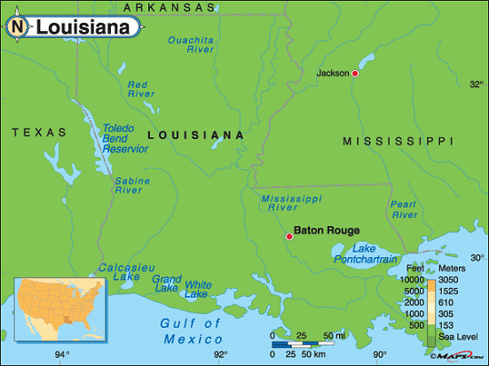 |
This elevation map of Louisiana illustrates the number of feet or meters the state rises above sea level. As you can see, Louisiana is not a mountainous state.In fact, the highest point in the state is only 535 feet above sea level.Driskill Mountain is located in Bienville Parish, in thenorth central part of the state, about 50 miles east ofShreveport and 17 miles southwest ofRuston. The lowest point in Louisiana is 8 feet below sea level in New Orleans. [ Topographic map | Arial photograph ] |
| Louisiana elevation map, Courtesy of Maps.com. |
Additional information
Louisiana maps: Additional maps and map links from NETSTATE.COM.
Louisiana geography: More Louisiana geography from NETSTATE.COM.
State elevations: State elevations listed by mean elevation, state high point and state low point.
Purchase Louisiana maps: Maps.com - The World's Largest Maps Store!
- Select map type by clicking on "category" to left on destination page.
- Use code NETSTATE at the checkout for 10% off orders of $50 or more!
- Over 6,000 products to choose from!