North Dakota Base and Elevation Maps (original) (raw)


The two maps shown here are digital base and elevation maps of North Dakota. Higher resolution maps like these and many other digital maps, wall maps, custom radius maps, travel maps, travel guides, map software, and globes and games, for business and the classroom, are available to purchase fromMaps.com - The World's Largest Maps Store!.Enter code "NETSTATE" at checkout for 10% off orders of $50 or more!
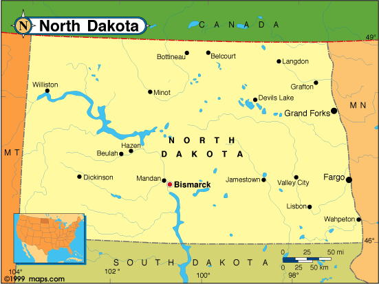 |
This North Dakota base map highlights the location of the state capitol,Bismarck, and major cities throughout the state. Portions of North Dakota's border states,Minnesota,South Dakota, andMontana are included to show the relationship between North Dakota and its neighbors. A small inset shows North Dakota among the other 47 Continental United States.North Dakota shares an international border with Canada on the north. |
|---|---|
| North Dakota base map, Courtesy of Maps.com. |
|
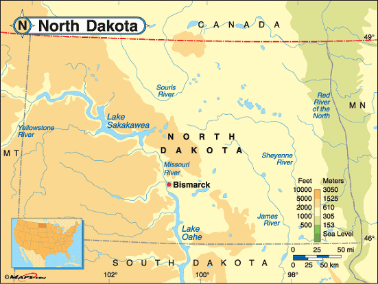 |
This elevation map of North Dakota illustrates the number of feet or meters the state rises above sea level. As you can see, all of North Dakota resides above 500 feet above sea level. The lowest point in the state, at 750 feet above sea level, is at the Red River on the eastern border. The land rises to the west to a high point of 3,506 feet above sea level at White Butte in the southwestern part of the state.White Butte is located in Slope County, about 7 miles southwest ofAmidon and about 19 miles northeast ofBowman. |
| North Dakota elevation map, Courtesy of Maps.com. |
Additional information
North Dakota maps: Additional maps and map links from NETSTATE.COM.
North Dakota geography: More North Dakota geography from NETSTATE.COM.
Purchase North Dakota maps: Maps.com - The World's Largest Maps Store!
- Select map type by clicking on "category" to left on destination page.
- Use code NETSTATE at the checkout for 10% off orders of $50 or more!
- Over 6,000 products to choose from!