Ohio Base and Elevation Maps (original) (raw)


The two maps shown here are digital base and elevation maps of Ohio. Higher resolution maps like these and many other digital maps, wall maps, custom radius maps, travel maps, travel guides, map software, and globes and games, for business and the classroom, are available to purchase fromMaps.com - The World's Largest Maps Store!.Enter code "NETSTATE" at checkout for 10% off orders of $50 or more!
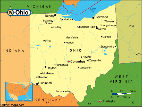 |
This Ohio base map highlights the location of the state capitol,Columbus, and major cities throughout the state. Portions of Ohio's border states,Pennsylvania,West Virginia,Kentucky,Indiana, andMichigan are included to show the relationship between Ohio and its neighbors. A small inset shows Ohio among the other 47 Continental United States. |
|---|---|
| Ohio base map, Courtesy of Maps.com. |
|
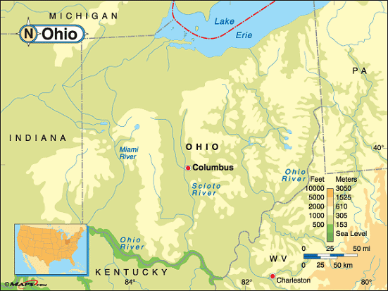 |
This elevation map of Ohio illustrates the number of feet or meters the state rises above sea level. As you can see, Ohio is not a land of extreme variances of elevation. Consisting of rolling plains, the low point in the state is 455 feet above sea level at the Ohio River and the high point in the state isCampbell Hill, at 1,549 feet above sea level.Campbell Hill rises in the rolling Till Plains in the western part of the state. Located in Logan County, Campbell Hill is about 50 miles northwest ofColumbus and about two miles east ofBellefontaine. |
| Ohio elevation map, Courtesy of Maps.com. |
Additional information
Ohio maps: Additional maps and map links from NETSTATE.COM.
Ohio geography: More Ohio geography from NETSTATE.COM.
Purchase Ohio maps: Maps.com - The World's Largest Maps Store!
- Select map type by clicking on "category" to left on destination page.
- Use code NETSTATE at the checkout for 10% off orders of $50 or more!
- Over 6,000 products to choose from!