Utah Base and Elevation Maps (original) (raw)


The two maps shown here are digital base and elevation maps of Utah.
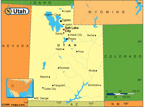 |
This Utah base map highlights the location of the state capitol,Salt Lake City, and major cities throughout the state. Portions of Utah's border states,Wyoming,Colorado,Arizona,Nevada, andIdaho are included to show the relationship between Utah and its neighbors. A small inset shows Utah among the other 47 Continental United States.The southeast corner of Utah touches the southwest corner of Colorado, the northwest corner of New Mexico, and the northwest corner of Arizona. This unique place is referred to asFour Corners. |
|---|---|
| Utah base map | |
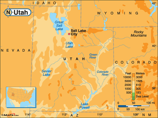 |
This elevation map of Utah illustrates the number of feet or meters the state rises above sea level. Utah is the third highest state in the union with amean elevation of 6,100 feet above sea level. Its lowest point is Beaverdam Wash at 2,000 feet above sea level.The highest point in Utah isKings Peak, at 13,528 feet above sea level. It's found in Duchesne County in the northeast part of the state about20 miles south of the Wyoming border. About 42 miles north ofDuchesne, in theUintus Wilderness Area, in theAshley andWasatch National Forests, Kings Peak is the seventh highest of the state's high points. [ Topographic Map ] |
| Utah elevation map |
Additional information
Utah maps: Additional maps and map links from NETSTATE.COM.
Utah geography: More Utah geography from NETSTATE.COM.