Wyoming Base and Elevation Maps (original) (raw)


The two maps shown here are digital base and elevation maps of Wyoming.
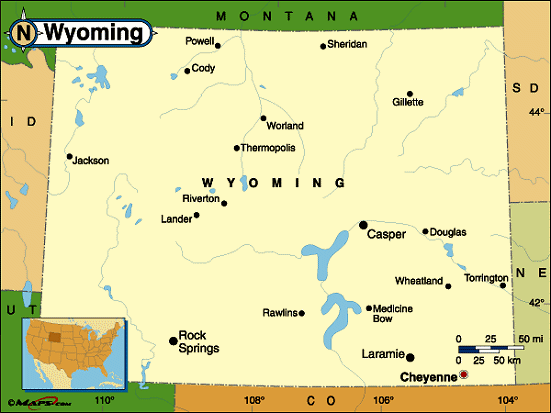 |
This Wyoming base map highlights the location of the state capitol,Cheyenne, and major cities throughout the state. Portions of Wyoming's border states,Montana,South Dakota,Nebraska,Colorado,Utah, andIdaho are included to show the relationship between Wyoming and its neighbors. A small inset shows Wyoming among the other 47 Continental United States. |
|---|---|
| Wyoming base map | |
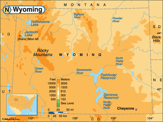 |
This elevation map of Wyoming illustrates the number of feet or meters the state rises above sea level.Wyoming has thesecond highest low point in the United States, behind only Colorado. The state's low point is at the Belle Fourche River (3,099 feet above sea level). The highest point in Wyoming isGannett Peak, located about 58 miles northwest ofLander. Also the highest point in theWind River Range in the central Rocky Mountains, the slopes of Gannett Peak lie withinBridger-Teton National Forest andShoshone National Forest in thewest-central part of the state. Gannett Peak reaches a height of 13,804 feet above sea level [ Topographic map | Arial photograph ] |
| Wyoming elevation map |
Additional information
Wyoming maps: Additional maps and map links from NETSTATE.COM.
Wyoming geography: More Wyoming geography from NETSTATE.COM.