map of Kalimantan (Borneo) dive areas and dive sites in Sangalaki, Derawan, Kakaban, Nabucco (Zubi) Print version (original) (raw)
 Diving
Back to report about diving in East Kalimantan - print version
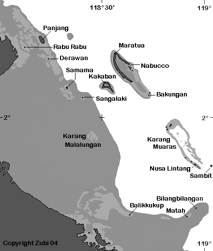
Map of the dive islands of Sangalaki, Derawan, Nabucco, Maratua, Samama and Kakaban in the Berau Archipelago (East Kalimantan)

Map of Sangalaki island and dive sites: 1. Channel Entrance / 2. Coral Gardens / 3. Turtle Town / 4. Sandy Ridge / 5. Manta Run / 6. Sherwood Forest / 7. Manta Parade / 8. Manta Avenue / 9. Eel Ridge / 10. Lighthouse / 11. The Rockies
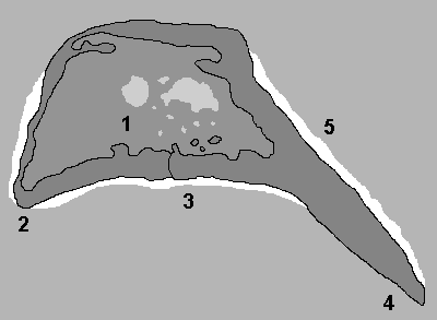
Map of Kakaban and its dive sites: 1. Jellyfish Lake / 3. Drop-off (for the other numbers I couldn't read the names)
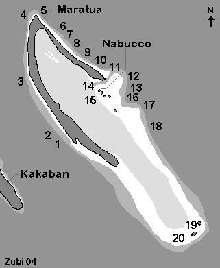
Map of Maratua and Nabucco with dive sites: 1. Sea Coral Garden / 2. Pygmy's House / 3. Turtle Trafic / 4. Batfish Alley / 5. Lighthouse / 6. Lumantang / 7. Diver's Delight / 8. Turtle Parade / 9. Turtle Bay / 10. Small Fish Country / 11. Big Fish Country / 12. Leo's Point / 13. Midnight Snapper Run / 14. Small Ridge / 15. Boat Jetty / 16. Sea Wall Garden / 17. Sea Wall / 18. Second Channel (Shark City) / 19. Tako Point / 20. Pandoga Point
This page www.starfish.ch/dive/map/Kalimantan-map.html . Copyright Teresa Zubi