Shiro, Texas, Grimes County. (original) (raw)

History in a Pecan Shell
Legend says the town's name was given by the postmaster who selected it from a nursery catalogue.The site was settled sometime in the 1830s, but no town proper appeared until the railroad arrived. In 1902 the townsite was laid out in anticipation and a post office was granted. A general store was opened in 1904, the Trinity and Brazos Valley railroad made their survey in 1905 and finally finished the line in 1908.
Families from Prairie Plains (three miles east) relocated to be near the railroad. In 1909 the congregation of a Prairie Plains Church moved their church building to Shiro.
Shiro became a shipping center for cattle, and cotton around 1913 and the town got a weekly newspaper by 1915. During the 20s Shiro's sixteen businesses lined the highway.
The town reached its zenith in 1936 with a population estimated at 500. By 1950 it was down to around 300 Shiroans. The population has been estimated at 205 from 1969 to the present.
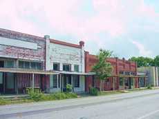 |
Storefronts along Highway 30 TE Photo, 7-04 |
|---|
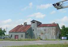 |
A former cotton gin now serves as a feed store (2004) TE Photo, 7-04 |
|---|
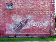 |
A ghost sign shows an attempted restoration. TE Photo, 7-04 |
|---|
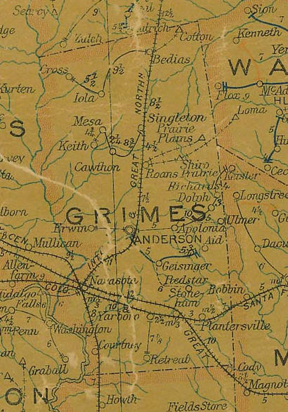
Grimes County 1907 postal map showing Shiro (on the railroad) and Prairie Plains NE of Anderson
From Texas state map #2090
Courtesy Texas General Land Office
Texas Escapes, in its purpose to preserve historic, endangered and vanishing Texas, asks that anyone wishing to share their local history, stories, landmarks and recent or vintage photos, please contact us.