Bastrop County Texas history, town list, vintage maps. (original) (raw)
Texas | Counties Central Texas South
30� 6' 0" N, 97� 18' 36" W (30.1, -97.31)
Population: 97,216 (2020)
74,171 (2010) 57,733 (2000) 38,263 (1990)
Total area: 896 square miles (2,320 km2)
888 square miles (2,300 km2) land
7.4 square miles (19 km2) water
| |  |
| ----------------------------------------------------------------------------------------------------------------- |
|
| ----------------------------------------------------------------------------------------------------------------- |
Bastrop County History
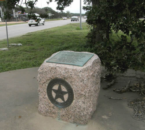
1936 Texas Centennial Marker:BASTROP COUNTY
A part of Austin's grant in 1821;
Created the municipality of Mina, 1834;
Became the County of Mina in the Republic of Texas, 1836.
Name changed to "Bastrop," December 18, 1837,
in honor of Felipe Enrique Neri, Baron de Bastrop, 1770-1829, land commissioner of Austin's Colony. Member of the Congress of Coahuila and Texas.
Bastrop, the County Seat
Bastrop County Town List
Cities, Towns & Ghost Towns: History, attractions, landmarks, architecture, monuments, museums, cemeteries, bridges, parks, vintage & contemporary images, area destinations, forum...
County Seat - Bastrop
Bastrop County Vintage Maps
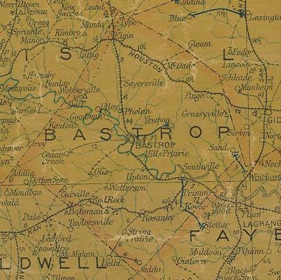
Bastrop County 1907 postal map
From Texas state map #2090
Courtesy Texas General Land Office
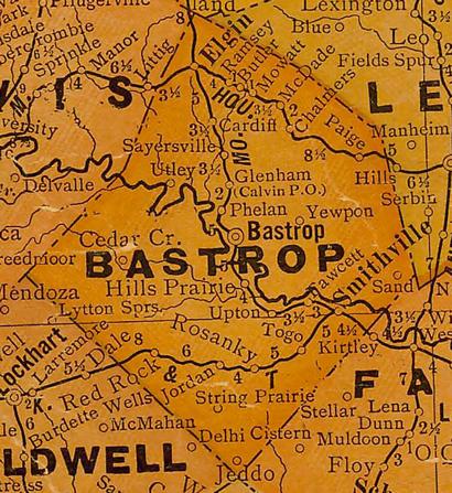
Bastrop County 1920s map
From Texas state map #10749
Courtesy Texas General Land Office

Bastrop County 1940s map
From Texas state map #4335
Courtesy Texas General Land Office
Bastrop County
1936 Texas Centennial Marker
Intersection of Loop 150 and SH 21,
near entrance to Bastrop State Park
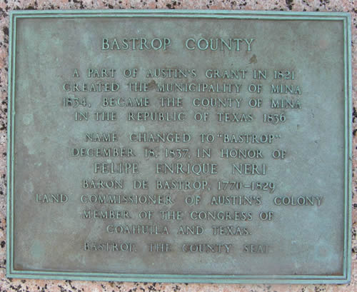
Bastrop County 1936 Texas Centennial marker
Photo courtesy Barclay Gibson, October 2009
Texas Escapes, in its purpose to preserve historic, endangered and vanishing Texas, asks that anyone wishing to share their local history and vintage/historic photos, please contact us.