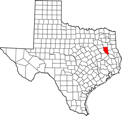
Cherokee County Texas. (original) (raw)
31� 50' 24" N, 95� 10' 12" W (31.84, -95.17)
Population: 50,412. (2020)
50,845 (2010) 46,659 (2000) 41,049 (1990)
Total area 1,062 square miles (2,750 km2):
1,053 square miles (2,730 km2) land
9.3 square miles (24 km2) water
| |  |
| ------------------------------------------------------------------------------------------------------------------- |
|
| ------------------------------------------------------------------------------------------------------------------- |
Cherokee County History
(Historical Marker on Courthouse Square in Rusk):CHEROKEE COUNTY
Cherokee County has a rich and varied history. Spanish and French explorers of the seventeenth century found Tejas and Hasinai Indians living in this area, and Spanish missions were established in the region. Driven out of the United States, the Cherokee Indians migrated to this area about 1822, and were here at the time of early Anglo-American colonization in the 1820s and 1830s. Under the administration of Republic of Texas President Mirabeau B.Lamar, the Cherokee were expelled from area in 1839.
Following formal creation of Cherokee County from Nacogdoches County in 1846, settlement of the area increased rapidly. Family farms and towns soon sprung up throughout the county. The building of roads and the advancement of railroads and river navigation contributed further to settlement. The chief economic base of the county from its beginning, agriculture remained a vital force as industrialization and business interests developed. The establishment of schools and churches formed the basis for the area's social history. Cherokee County has been the birthplace of two Texas governors, one governor of Wyoming and one Speaker of the Texas House of Representatives.
1986
Cherokee County Town List
Cities, Towns & Ghost Towns: History, attractions, landmarks, architecture, monuments, museums, cemeteries, bridges, parks, vintage & contemporary images, area destinations, forum...County Seat - Rusk
Cherokee County Vintage Maps
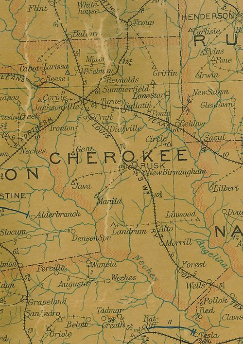
Cherokee County 1907 postal map
From Texas state map #2090
Courtesy Texas General Land Office
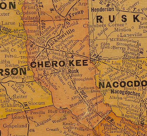
Cherokee County 1920s map
From Texas state map #10749
Courtesy Texas General Land Office
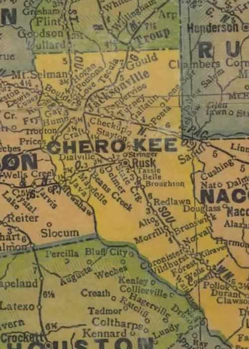
Cherokee County 1940s map
From Texas state map #4335
Courtesy Texas General Land Office
Texas Escapes, in its purpose to preserve historic, endangered and vanishing Texas, asks that anyone wishing to share their local history, stories, landmarks and recent or vintage/historic photos, please contact us.