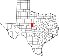
Coleman County, Texas. (original) (raw)
Texas | Counties Texas Panhandle
31� 46' 12" N, 99� 27' 0" W (31.77, -99.45)
Population: 7,684 (2020)
8,895 (2010) 9,235 (2000) 9,710 (1990)
Total area 1,281 square miles (3,320 km2):
1,281 square miles (3,320 km2) land
19 square miles (49 km2) water
| |  |
| ----------------------------------------------------------------------------------------------------------------- |
|
| ----------------------------------------------------------------------------------------------------------------- |
Coleman County History
(from 1936 Texas Centennial Marker - 0.6 mile N of Coleman on US 84)In early Texas had Apache, Comanche, Kiowa camps and mountain lookouts. White settlement began at Camp Colorado, U.S. 2nd Cavalry Post on Jim Ned Creek, 1857.
County was created Feb. 1, 1858. Named for Robert M. Coleman (1799-1837), a signer of Texas Declaration of Independence and a hero of the Battle of San Jacinto. To south part of county, 1862, came John Chisum, to raise cattle to be furnished to Confederate troops fighting Civil War.
County was organized Oct. 6, 1864.
Courts first met at Camp Colorado.
Coleman was approved as county seat April 28, 1876.
Coleman County Town List
Cities, Towns & Ghost Towns: History, attractions, landmarks, architecture, monuments, museums, cemeteries, bridges, parks, vintage & contemporary images, area destinations, forum...
County Seat - Coleman
Coleman County Vintage Maps
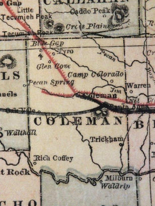
Coleman County 1882 map
From Texas state map #2134
Courtesy Texas General Land Office
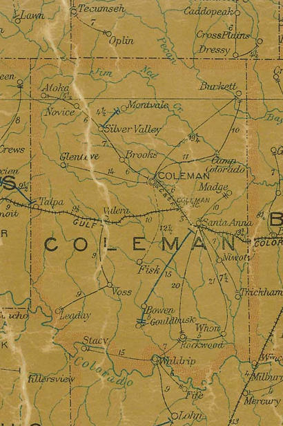
Coleman County 1907 postal map
From Texas state map #2090
Courtesy Texas General Land Office
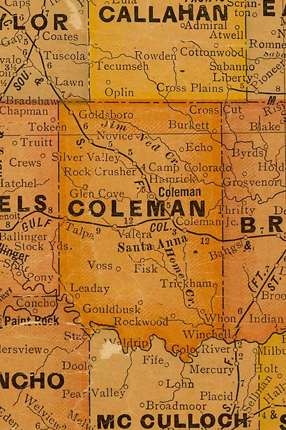
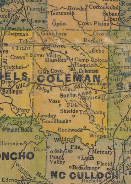
Coleman County 1920s map
From Texas state map #10749
Courtesy Texas General Land Office
Coleman County 1940s map
From Texas state map #4335
Courtesy Texas General Land Office
Texas Escapes, in its purpose to preserve historic, endangered and vanishing Texas, asks that anyone wishing to share their local history, stories, landmarks and recent or vintage photos, please contact us.