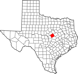
Coryell County, Texas. (original) (raw)
Texas | Counties Central Texas North
31� 23' 24" N, 97� 48' 0" W (31.39, -97.8)
Population: 83,093 (2020)
75,388 (2010) 74,978 (2000) 64,213 (1990)
Total area 1,057 square miles (2,740 km2):
1,052 square miles (2,720 km2) land
4.7 square miles (12 km2) water
| |  |
| ----------------------------------------------------------------------------------------------------------------- |
|
| ----------------------------------------------------------------------------------------------------------------- |
Coryell County History
(from 1936 Texas Centennial Marker)
CORYELL COUNTY
Formed from Bell County;
created February 4, 1854
Organized March 4, 1854.
Named in Honor of James Coryell, born in Tennesse in 1796; a member of the Bowie Expedition to the old San Saba Silver Mines in 1831; a Texas Ranger; killed by Indians near Fort Milam May 27, 1837.
County seat Fort Gates 1854;
Gatesville since.
Coryell County Town List
Cities, Towns & Ghost Towns: History, attractions, landmarks, architecture, monuments, museums, cemeteries, bridges, parks, vintage & contemporary images, area destinations, forum...County Seat - Gatesville
Coryell County Vintage Maps
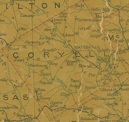
Coryell County 1907 postal map
From Texas state map #2090
Courtesy Texas General Land Office
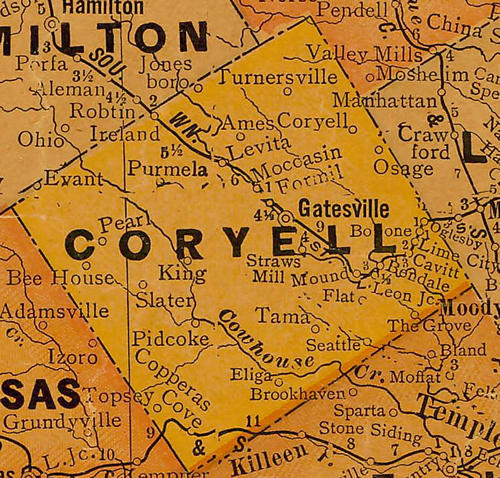
Coryell County 1920s map
From Texas state map #10749
Courtesy Texas General Land Office
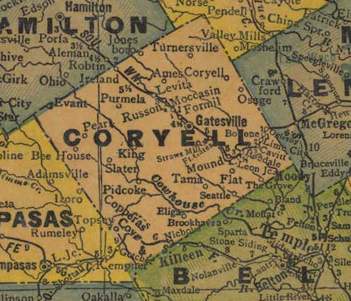
Coryell County 1940s map
From Texas state map #4335
Courtesy Texas General Land Office
Texas Escapes, in its purpose to preserve historic, endangered and vanishing Texas, asks that anyone wishing to share their local history, stories, landmarks and recent or vintage photos, please contact us.