Denton County Texas. (original) (raw)
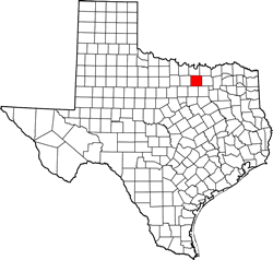
Texas | Counties 33� 12' 0" N, 97� 7' 12" W (33.2, -97.12)
Population: 906,422 (2020) 662,614 (2010)
Total area: 953 square miles (2,470 km2)
878 square miles (2,270 km2) land
75 square miles (190 km2) water
| |  |
| --------------------------------------------------------------------------------------------------------------- |
|
| --------------------------------------------------------------------------------------------------------------- |
Denton County History
Denton County was established by the Texas Legislature on April 11, 1846. Prior to this time only a few early settlers had lived in what is now Denton County. After Texas joined the union, military protection form marauding Indians caused settlement of this territory to increase.
Land for Denton County was carved out of Fannin County. Pioneers named the new county after John B. Denton, a pioneer preacher and lawyer who was killed in an Indian fight in 1841.
Due to hardships, the county seat was moved several times in the 1850's. The present day county seat was established and lots sold at auction in 1857. Primary among the reasons for this final move was the need to locate the county seat central to settlements in Pilot Point in the north and Lewisville in the south.
Sources:
Most of the information presented here was extracted from the Texas Historical Commission's Sites Atlas. (http://atlas.thc.state.tx.us/) Other information came from the Denton county government web site. ( http://dentoncounty.com/)
Copyright �
Sam Fenstermacher
All rights reserved
Denton County Town List
Cities, Towns & Ghost Towns: History, attractions, landmarks, architecture, monuments, museums, cemeteries, bridges, parks, vintage & contemporary images, area destinations, hotels, forum, and more..County Seat - Denton
Book Hotel Here - Denton Hotels
Denton County, Texas Vintage Maps

Denton County 1907 postal map
From Texas state map #2090
Courtesy Texas General Land Office
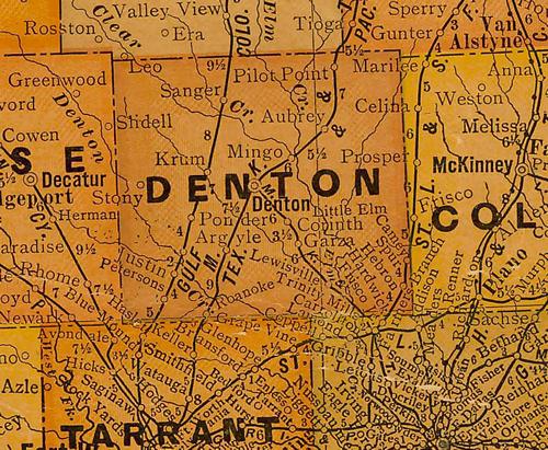
Denton County 1920s map
From Texas state map #10749
Courtesy Texas General Land Office
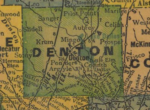
Denton County 1940s map
From Texas state map #4335
Courtesy Texas General Land Office
Texas Escapes, in its purpose to preserve historic, endangered and vanishing Texas, asks that anyone wishing to share their local history, stories, landmarks and recent or vintage/historic photos, please contact us.