Johnson County Texas. (original) (raw)
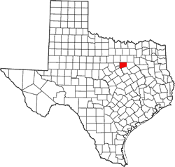
Texas | Counties 32� 22' 48" N, 97� 21' 36" W (32.38, -97.36)
Population: 163,274 est. (2016) 150,934 (2010)
Total area: 734 square miles (1,900 km2)
725 square miles (1,880 km2) land
9.8 square miles (25 km2) water
| |  |
| ----------------------------------------------------------------------------------------------------------------- |
|
| ----------------------------------------------------------------------------------------------------------------- |
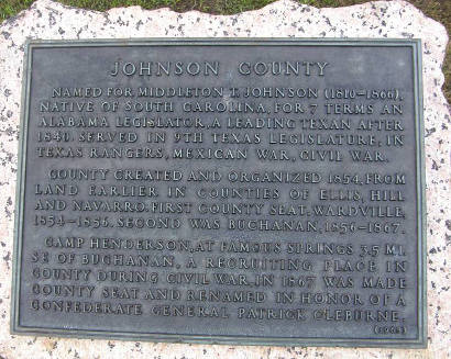
Johnson County History
(from 1936 Texas Centennial Marker)
Named for Middleton T. Johnson (1810-1866), native of South Carolina, for 7 terms an Alabama legislator, a leading Texan after 1840. Served in 9th Texas Legislature; in Texas Rangers, Mexican War, Civil War.
County created and organized 1854, from land earlier in counties of Ellis, Hill and Navarro. First county seat, Wardville, 1854-1856. Second was Buchanan, 1856-1867.
Camp Henderson, at famous springs 3.5 miles southeast of Buchanan, a recruiting place in county during Civil War, in 1867 was made county seat and renamed in honor of a Confederate General Patrick Cleburne.
Johnson County Town List
Cities, Towns & Ghost Towns: History, attractions, landmarks, architecture, monuments, museums, cemeteries, bridges, parks, vintage & contemporary images, area destinations, hotels, and forum.County Seat - Cleburne
Book Hotel Here - Cleburne Hotels
Johnson County Vintage Maps
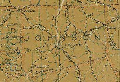
Johnson County 1907 postal map
From Texas state map #2090
Courtesy Texas General Land Office
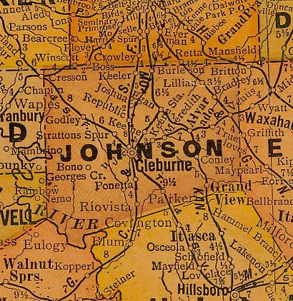
Johnson County 1920s map
From Texas state map #10749
Courtesy Texas General Land Office
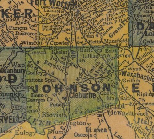
Johnson County 1940s map
From Texas state map #4335
Courtesy Texas General Land Office
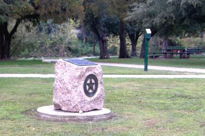
Johnson County Centennial Marker
2nd and Hillsboro Street, Cleburne City Park, Cleburne
Texas Escapes, in its purpose to preserve historic, endangered and vanishing Texas, asks that anyone wishing to share their local history, stories, landmarks and vintage/historic photos, please contact us.