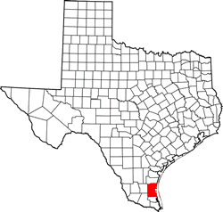
Kenedy County Texas. (original) (raw)
Texas | Counties 26� 55' 48" N, 97� 37' 12" W (26.93, -97.62)
Population: 404 est. (2016) 416 (2010)
Total area: 1,946 square miles (5,040 km2)
1,458 square miles (3,780 km2) land
487 square miles (1,260 km2) water
| |  |
| --------------------------------------------------------------------------------------------------------------- |
|
| --------------------------------------------------------------------------------------------------------------- |
Kenedy County History
1936 Texas Centennial Marker (US 77 about 3 miles N of Sarita):
KENEDY COUNTY
Created April 2, 1921 out of Cameron, Willacy and Hidalgo counties.
Named for Mifflin Kenedy 1818-1895, sent to Texas in 1846 on United States Army supply boats, commercial navigator of the Rio Grande 1848-1860.
Sarita is the county seat.
Kenedy County Town List
Cities, Towns & Ghost Towns: History, attractions, landmarks, architecture, monuments, museums, cemeteries, bridges, parks, vintage & contemporary images, area destinations, hotels, and forum.
County Seat - Sarita
Book Hotel Here - Raymondville Hotels
Kenedy County Vintage Maps
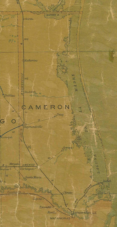
Cameron County 1907 postal map showing the area that later became Kenedy & Willacy County
From Texas state map #2090
Courtesy Texas General Land Office
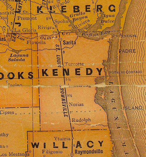
Kenedy County 1920s map
From Texas state map #10749
Courtesy Texas General Land Office
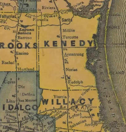
Kenedy County 1940s map
From Texas state map #4335
Courtesy Texas General Land Office
Texas Escapes, in its purpose to preserve historic, endangered and vanishing Texas, asks that anyone wishing to share their local history, stories, landmarks and vintage/historic photos, please contact us.