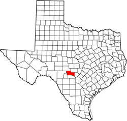
Kerr County Texas. (original) (raw)
Texas | Counties 30� 3' 36" N, 99� 21' 0" W (30.06, -99.35)
Population: 52,598 (2020) 49,625 (2010)
Total area: 1,107 square miles (2,870 km2)
1,103 square miles (2,860 km2) land
4.0 square miles (10 km2) water
| |  |
| ----------------------------------------------------------------------------------------------------------- |
|
| ----------------------------------------------------------------------------------------------------------- |
Kerr County History
(from 1936 Texas Centennial Marker - On SH 27 about 1.3 miles E of Kerrville)KERR COUNTY
Formed from Bexar County;
created January 26, 1856;
organized March 22, 1856.
Named in honor of James Kerr, 1790-1850; the first American settler on the Guadalupe River; general manager of DeWitt's Colony; signer of the Texas Declaration of Independence; member of the Third Texas Congress.
County Seat, Kerrsville (afterwards Kerrville), 1856-1860; Comfort, 1860-1862, Kerrville since.
Kerr County Town List
Cities, Towns & Ghost Towns: History, attractions, landmarks, architecture, monuments, museums, cemeteries, bridges, parks, vintage & contemporary images, area destinations, hotels, and forum.County Seat - Kerrville
Book Hotel Here - Kerrville Hotels
Kerr County Vintage Maps
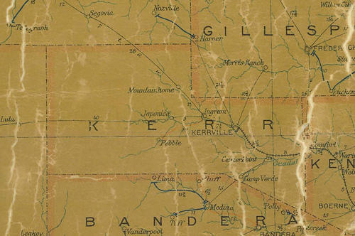
Kerr County 1907 postal map
From Texas state map #2090
Courtesy Texas General Land Office
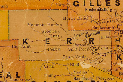
Kerr County 1920s map
From Texas state map #10749
Courtesy Texas General Land Office
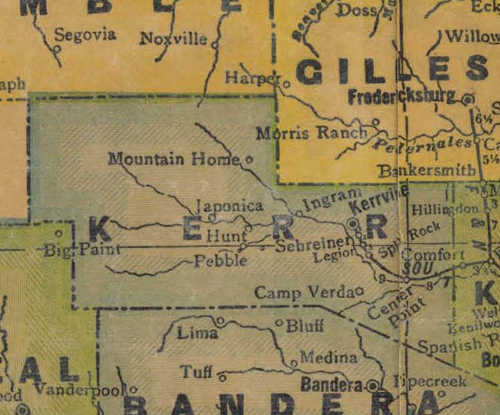
Kerr County 1940s map
From Texas state map #4335
Courtesy Texas General Land Office
Texas Escapes, in its purpose to preserve historic, endangered and vanishing Texas, asks that anyone wishing to share their local history, stories, landmarks and vintage/historic photos, please contact us.