Lamb County Texas history, towns, courthouse, vintage maps. (original) (raw)
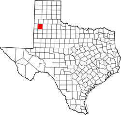
Texas | Counties 34� 4' 12" N, 102� 21' 0" W (34.07, -102.35)
Population: 13,275 Est. (2016) 13,977 (2010)
Total area: 1,018 square miles (2,640 km2)
1,016 square miles (2,630 km2) land
1.5 square miles (3.9 km2) water
| |  |
| ----------------------------------------------------------------------------------------------------------- |
|
| ----------------------------------------------------------------------------------------------------------- |
Lamb County History
1936 Texas Centennial Marker (on US Hwy 70, 1.5 mile W of Olton) LAMB COUNTY
Formed From Young and Bexar Territories.
Created August 21, 1876.
Organized June 20, 1908.
Named in honor of George A. Lamb, 1814-1836, a Second Lieutenant who fell in the first charge at the Battle of San Jacinto. Olton, County Seat.
(1946 Littlefield County Seat)
Lamb County Town List
Cities, Towns & Ghost Towns: History, attractions, landmarks, architecture, monuments, museums, cemeteries, bridges, parks, vintage & contemporary images, area destinations, hotels, and forum.County Seat - Littlefield
Book area Hotels - Littlefield Hotels
Lamb County Vintage Maps
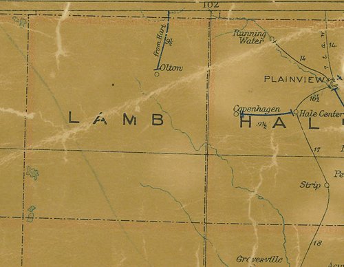
Lamb County 1907 postal map
From Texas state map #2090
Courtesy Texas General Land Office
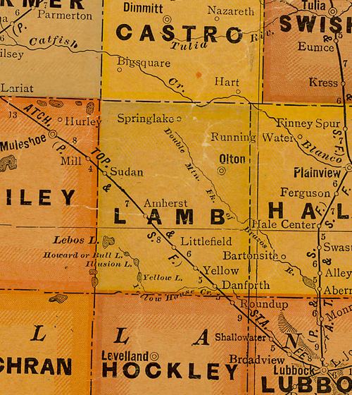
Lamb County 1920s map
From Texas state map #10749
Courtesy Texas General Land Office
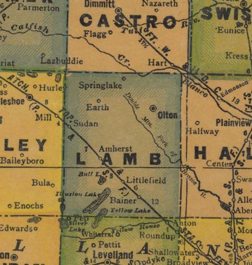
Lamb County 1940s map
From Texas state map #4335
Courtesy Texas General Land Office