Limestone County Texas. (original) (raw)
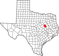
Texas | Counties 31� 32' 24" N, 96� 34' 48" W (31.54, -96.58)
Population: 23,468 est. (2016) 23,384 (2010)
Total area: 933 square miles (2,420 km2)
905 square miles (2,340 km2) land
28 square miles (73 km2) water
| |  |
| ---------------------------------------------------------------------------------------------------------------------- |
|
| ---------------------------------------------------------------------------------------------------------------------- |
Limestone County History
1936 Centennial Marker:
LIMESTONE COUNTY
Formed from Robertson County.
Created April 11, 1846.
Organized August 18, 1846.
Named for the rock formation in the region.
County seat Springfield, 1846,
Groesbeck since 1874.
Limestone County Town List
Cities, Towns & Ghost Towns: History, attractions, landmarks, architecture, monuments, museums, cemeteries, bridges, parks, vintage & contemporary images, area destinations, hotels, and forum.
County Seat - Groesbeck
Book Hotel -
Limestone County Vintage Maps
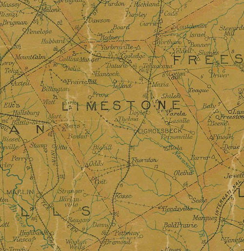
Limestone County 1907 postal map
From Texas state map #2090
Courtesy Texas General Land Office
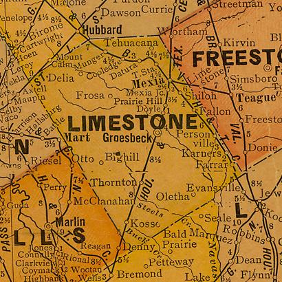
Limestone County 1920s map
From Texas state map #10749
Courtesy Texas General Land Office
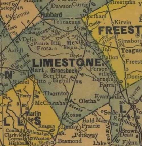
Limestone County 1940s map
From Texas state map #4335
Courtesy Texas General Land Office
Texas Escapes, in its purpose to preserve historic, endangered and vanishing Texas, asks that anyone wishing to share their local history, stories, landmarks and vintage/historic photos, please contact us.