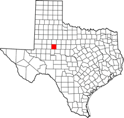
Mitchell County Texas. (original) (raw)
Texas | Counties 32� 18' 0" N, 100� 55' 12" W (32.3, -100.92)
Population: 8,990 (2020)
9,403 (2010) 9,698 (2000) 8,016 (1990) 9,088 (1980)
Total area: 916 square miles (2,370 km2)
911 square miles (2,360 km2) land
4.8 square miles (12 km2) water
| |  |
| ------------------------------------------------------------------------------------------------------------------- |
|
| ------------------------------------------------------------------------------------------------------------------- |
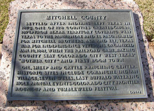
Mitchell County History
(from 1936 Texas Centennial Marker) MITCHELL COUNTY
Settled after Indians left Texas in 1875. One of 129 counties created (Aug. 21, 1876) from Bexar Territory covering West Texas to the Panhandle and El Paso. Named for Mitchell Brothers, Asa and Eli, Texas War for Independence veterans. Organized Jan. 10, 1881 when the railroad came, making county seat Colorado City West Texas' "Mother City" and first boom town.
Oil, sheep and cattle ranching center. Historic sites include Comanche Indian Village; seven wells, last buffalo watering hole. Annual events: Colorado City Frontier Roundup and Tumbleweed Festival.
(1965)
Mitchell County Town List
Cities, Towns & Ghost Towns: History, attractions, landmarks, architecture, monuments, museums, cemeteries, bridges, parks, vintage & contemporary images, area destinations, hotels, and forum.County Seat - Colorado City
Book Hotel Here - Colorado City Hotels
Mitchell County Vintage Maps
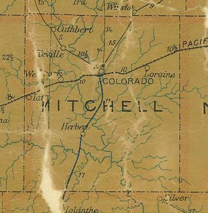
Mitchell County 1907 postal map
From Texas state map #2090
Courtesy Texas General Land Office
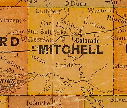
Mitchell County 1920s map
From Texas state map #10749
Courtesy Texas General Land Office

Mitchell County 1940s map
From Texas state map #4335
Courtesy Texas General Land Office
Mitchell County Texas Centennial Marker
Texas Escapes, in its purpose to preserve historic, endangered and vanishing Texas, asks that anyone wishing to share their local history, stories, landmarks and vintage/historic photos, please contact us.