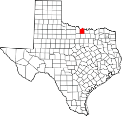
Montague County Texas. (original) (raw)
Texas | Counties 33� 40' 12" N, 97� 43' 48" W (33.67, -97.73)
Population: 19,414 Est. (2016) 19,719 (2010)
Total area: 38 square miles
931 square miles (2,410 km2) land
7.4 square miles (19 km2) water
| |  |
| ------------------------------------------------------------------------------------------------------------------- |
|
| ------------------------------------------------------------------------------------------------------------------- |
Montague County History
(from 1936 Texas Centennial Marker -
on US 81, in Meyers Park on west side of Bowie)
MONTAGUE COUNTY
Created December 24, 1857;
organized August 2, 1858;
named in honor of Daniel Montague 1798-1876; Pioneer Texas surveyor and Indian fighter; commander of a company in the Mexican War;
Montague, County Seat
Montague County Town List
Cities, Towns & Ghost Towns: History, attractions, landmarks, architecture, monuments, museums, cemeteries, bridges, parks, vintage & contemporary images, area destinations, hotels, and forum.County Seat - Montague
Book Hotel Here - Bowie Hotels
Montague County Vintage Maps
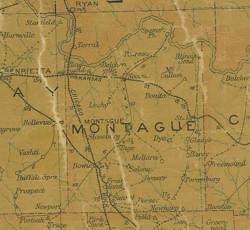
From 1907 Texas state map #2090 showing Montague County
Courtesy Texas General Land Office
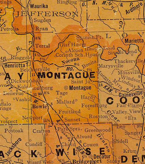
From 1920 Texas state map #10749 showing Montague County
Courtesy Texas General Land Office
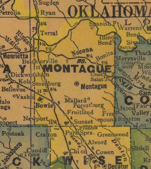
From 1940 Texas state map #4335 showing Montague County
Courtesy Texas General Land Office
Texas Escapes, in its purpose to preserve historic, endangered and vanishing Texas, asks that anyone wishing to share their local history and vintage/historic photos, please contact us.