Palo Pinto County Texas. (original) (raw)
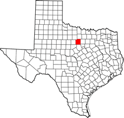
Texas | Counties 32� 45' 0" N, 98� 18' 36" W (32.75, -98.31)
Population: 28,053 est. (2016) 28,111 (2010)
Total area: 986 square miles (2,550 km2)
952 square miles (2,470 km2) land
34 square miles (88 km2) water
| |  |
| ---------------------------------------------------------------------------------------------------------------------- |
|
| ---------------------------------------------------------------------------------------------------------------------- |
Palo Pinto County History
(1936 Texas Centennial Marker - On Hwy 180, 1.25 miles W of Palo Pinto )PALO PINTO COUNTY
Created August 27, 1856, from Navarro and Bosque counties;
organized in 1857.
Spanish name Palo Pinto refers to spotted oak, a common regional tree having bark with a mottled appearance. Good hunting and abundant water made area a favored indian locality.
The first anglo-american settlers arrived in 1850's, including Texas cattlemen and trail-blazers Charles Goodnight and Oliver Loving.
The discovery, in 1880, of mineral water and arrival of Texas & Pacific railroad brought an influx of settlers and helped establish a strong economy.
The county seat, first named Golconda in 1856, was renamed Palo Pinto in 1858.
Erected by the State of Texas -1973
Palo Pinto County Town List
Cities, Towns & Ghost Towns: History, attractions, landmarks, architecture, monuments, museums, cemeteries, bridges, parks, vintage & contemporary images, area destinations, hotels, and forum.County Seat - Palo Pinto
Book Hotel Here - Mineral Wells Hotels
Palo Pinto County Vintage Maps
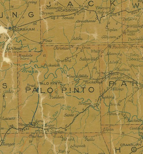
Palo Pinto County 1907 postal map
From Texas state map #2090
Courtesy Texas General Land Office
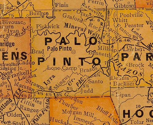
Palo Pinto County 1920s map
From Texas state map #10749
Courtesy Texas General Land Office
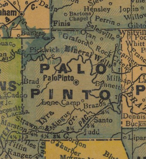
Palo Pinto County 1940s map
From Texas state map #4335
Courtesy Texas General Land Office
Texas Escapes, in its purpose to preserve historic, endangered and vanishing Texas, asks that anyone wishing to share their local history, stories, landmarks and recent/vintage/historic photos, please contact us.