Sabine Pass Battleground State Park & Historic Site. (original) (raw)
Getting There
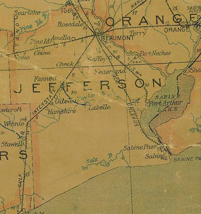
Head south from Beaumont on Highways 89/96/ 287. After passing numerous prisons and the site of Spindletop on your right, you'll pass the Nederland exits and come to the intersection with highway 87. Take a right and drive until it intersects with highway 82. To the south you'll see the easy-to-spot MLK Bridge. Turn right here on highway 82 and this will take you into Sabine Pass. Turning left would take you to downtown Port Arthur. Long before you come to Sabine Pass, you'll start noticing torn and twisted debris with an occasional stranded boat on the horizon. As you enter Sabine Pass, you can see that a lot of debris has been removed - based on the numerous bare foundations and empty posts that once held signs.
The Sabine Cemetery is just to the west of the town's main intersection while the battleground is several miles south. To get to the battleground park, at the intersection go right on 3322. This road follows the Sabine River estuary and is plied by ships entering Port Arthur, the gas terminals and refineries or the Neches River which passes alongside downtown Beaumont.
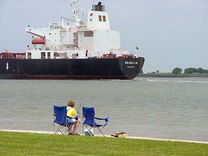
A view of the Sabine River estuary at the edge of the battlefield.
TE photo, July 2003
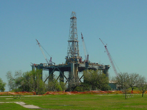
Offshore rigs are restored and refurbished just outside the park boundaries. The foreground is the park itself - surrounded by orange construction-site fencing. As of March 2007 the boat ramp was accessible.
TE Photo March 2007
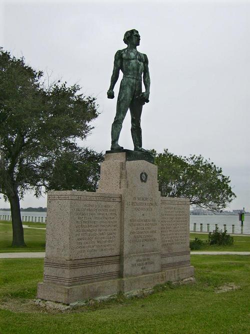
The battleground boat ramp and parking lot is open although most of the visitor's area (including Dick Dowling's statue) is currently surrounded by ugly flexible orange construction fencing. The status of the once-numerous historical markers is not known. The thing least affected by the storm is the grouping of WWII era ammunition bunkers.
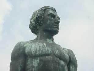 |
Onward, through the guano! A clean-shaven version of Dick Dowling photographed pre-Rita. TE Photo 2003 |
|---|
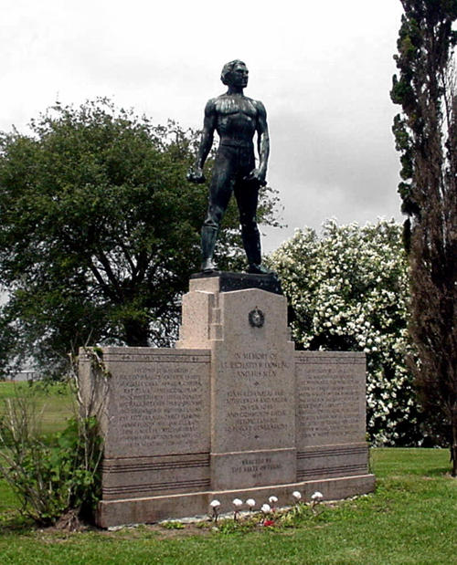
The statue and pedestal inscribed with the names of Dowling's command. (Dowling's niece once stated that this was her favorite statue of her uncle. She said that she always hated the mustache on the Dowling statue in Houston's Herman Park.
TE photo, 2003
Historical Marker - In Sabine Pass Battleground
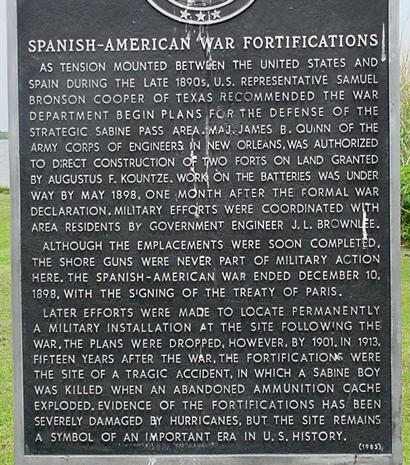
Spanish-American War Fortifications
As tension mounted between the United States and Spain during the late 1890s, U. S. Representative Samuel Bronson Cooper of Texas recommended the War Department begin plans for the defense of the strategic Sabine Pass area. Maj. James B. Quinn of the Army Corps of Engineers in New Orleans, was authorized to direct construction of two forts on land granted by Augustus F. Kountze. Work on the batteries was under way by May 1898, one month after the formal war declaration. Military efforts were coordinated with area residents by government engineer J. L. Brownlee.
Although the emplacements were soon completed, the shore guns were never part of military action here. The Spanish-American War ended December 10, 1898, with the signing of the Treaty of Paris.
Later efforts were made to locate permanently a military installation at the site following the war. The plans were dropped, however, by 1901. In 1913, fifteen years after the war, the fortifications were the site of a tragic accident, in which a Sabine boy was killed when an abandoned ammunition cache exploded. Evidence of the fortifications has been severely damaged by hurricanes, but the site remains a symbol of an important era in U. S. history.
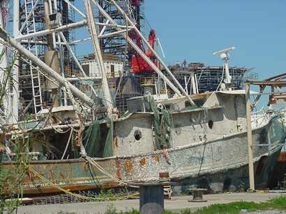
One of the shrimp boats on the way to the battlefield.
TE photo, March 2007
The road south from the battlefield is an unpaved road that eventually reaches the site of Sabine City, which existed only to the Civil War. The town then moved inland creating Sabine Pass. This road passes a Coast Guard station and several shrimpboats which have been raised but are not yet seaworthy.
The decommissioned Sabine Pass Lighthouse (below) is visible across the marshes on the Louisiana side. The faded paint and weathered cement give it a watercolor effect even when viewed in full sun.
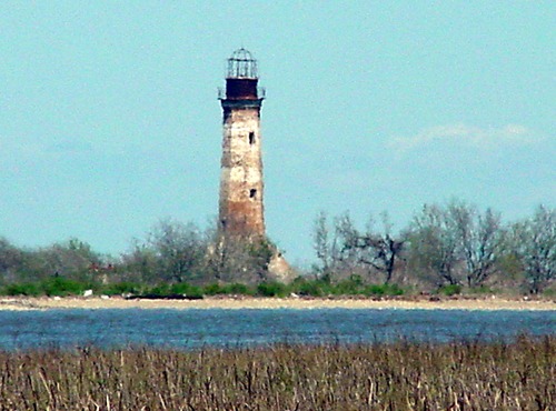
The decommissioned Sabine Pass Lighthouse
TE photo, March 2007
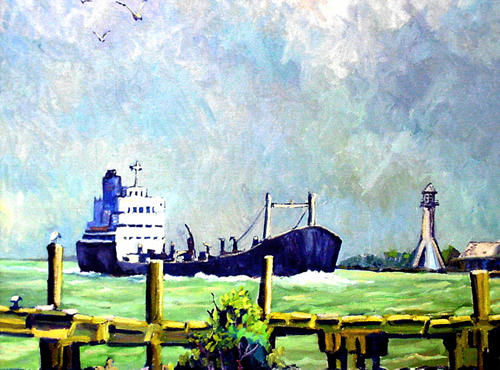
The Old Sabine Pass Lighthouse is included in this oil painting that now hangs in Port Arthur's Museum of the Gulf Coast
TE Photo 2003
Sabine Pass Battleground State Historic Site Information
Sabine Pass Battleground State Historic Site is a Texas Historical Commission property
Hours Open: Daily, 8 a.m.�5 p.m.
Closed: Thanksgiving, Christmas Eve, Christmas Day, New Year�s Eve and New Year�s Day
Admission Fees - Free
First published March 2007
Updated August 2010