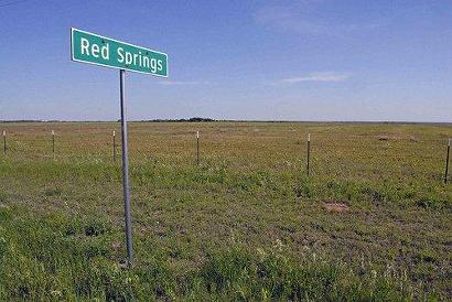
Red Springs, Texas, Baylor County. (original) (raw)
History on a Pinhead
The site had been a watering hole for buffalo and Indians, years before settlement. The springs flowed from a clay bank of the Salt Fork of the Brazos River, giving the name �red.� In the late 1890s a trading post was built here and with the arrival of the railroad in 1900 (The Fort Worth and Denver City) growth seemed unstoppable. The history and early population figures are missing, but the 1940 census showed 100 people � served by four stores and a school.
The 1980 census counted the same number of people but by 1990 it had reached 81. In the ten years since it has decreased to a mere 42 citizens.

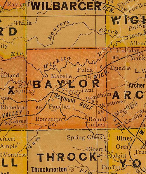
Baylor County 1920s map showing Red Springs
near Knox County line
From Texas state map #10749
Courtesy Texas General Land Office
Texas Escapes, in its purpose to preserve historic, endangered and vanishing Texas, asks that anyone wishing to share their local history, stories, landmarks and recent or vintage photos, please contact us.