original ) (raw )
29,00€
A Cartographic Design Project Clara Olóriz Sanjuán
Landscape as Territory is a cartographic book project that critically addresses the agency of architects in the so-called ‘Urban Age,’ understanding the notion of ‘territory’ as a field of design praxis through which interconnected landscapes are produced. Territory, understood as a ‘political technology,’ has the capacity to involve architects and designers into complex social, political, technical, legal, strategic and economic processes that are both historical and geographical engines of contemporary urbanization. Territorial praxis is interrogated in a collection of threaded theory and design contributions where essays pose key questions that are addressed through projective cartographies, unfolding arguments related to three sections: (1) territory, (2) critical cartographies and (3) agency.
EBOOK EDITION
Size: 21 x 27,5 cm
Illustrations: Color
Cover: Soft Cover
Pages: 220
Publication date: November 2019
Published by: Actar Publishers & Architectural Association ISBN: English 9781948765190Price: 29€/ $34.95/ £27
KERB 24 Louella Exton, Kim Morte, Hayden Matthys, Millicent Gunner, Emma Groot & Rosalea MonacellaKerb Journal is a 24 year running, produced by the Landscape Architecture program of RMIT University Louella Exton, Kim Morte, Hayden Matthys, Millicent Gunner, Emma Groot Kerb Journal is a 24 year running, produced by the Landscape Architecture program of RMIT University. 2016 sees Kerb24 focus on the thematic of Territory and its place in the discourse of Landscape Architecture and the broader design industry. Territories start off as nonphysical, often simple ideas, emerging in the physical and becoming a perpetual mixture of the two. Often formed to acquire resources, yet inherently a resource. Land is seized for economic gain, borders are traversed through changes to regulations, and new territories of control are born from land reclamation where previously none existed. Imposing order and control over landscapes in varying states of flux. Conflict often leads to territories shifting or being taken by force. Yet as often as the former, unions of territories can proliferate through consensus and peaceful treaties. They can be rigid or malleable and perceptions of territories 27,50€
Third Coast Atlas Daniel Ibañez, Clare Lyster, Charles Waldheim, Mason WhiteIt assembles a multi-layered, empirical description of urbanization processes within the drainage basins of the five Great Lakes and the Saint Lawrence River Prelude to a Plan Daniel Ibañez, Clare Lyster, Charles Waldheim, Mason White Third Coast Atlas: Prelude to a Plan describes the conditions for urbanization across the Great Lakes region. It assembles a multi-layered, empirical description of urbanization processes within the drainage basins of the five Great Lakes and the Saint Lawrence River. This thick description encompasses a range of representational forms including maps, plans, diagrams, timelines, and photographs, as well as speculative design research projects and critical texts. Postponing diagnosis, let alone treatment of these conditions, Third Coast Atlas aspires to simply describe. It proposes a new geographic gestalt for urban analysis. Superimposed upon the North American continent, and with easily recognizable yet divergent political and geological borders, this megaregion traverses portions of eight U.S. states and two Canadian provinces, as well as the world's largest collection of surficial fresh water. Third Coast Atlas characterizes the littoral edge as a distinct field of urbanization, and constructs a
Buy Ebook
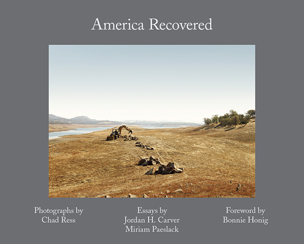
America Recovered Chad Ress, Jordan H. Carver, Miriam PaeslackAmerica Recovered reveals the point where abstract political processes manifest themselves in the physical world, thus providing an alternate means of experiencing the contemporary American landscape. Chad Ress, Jordan H. Carver, Miriam Paeslack America Recovered reveals the point where abstract political processes manifest themselves in the physical world, thus providing an alternate means of experiencing the contemporary American landscape. Collectively, the images and essays show what aspects of our everyday lives are being assigned value in the promise of a recovered America. In 2009 President Obama signed the American Recovery and Reinvestment Act known as the stimulus bill. Along with the bill, the administration launched Recovery.gov , a website to foster greater accountability and transparency in the use of covered funds. America Recovered collects forty images that mark one of the only efforts to document the breadth of projects funded by the 2009 American Recovery and Reinvestment Act. Unlike the New Deal and other programs designed for employment and infrastructural development, the Recovery Act was passed without any funds dedicated for photographic documentation. Using an official government website as 30,00€
Buy Ebook


 Quickview
  Quickview
 Quickview