Introduction - Documentation Center (original) (raw)
Introduction
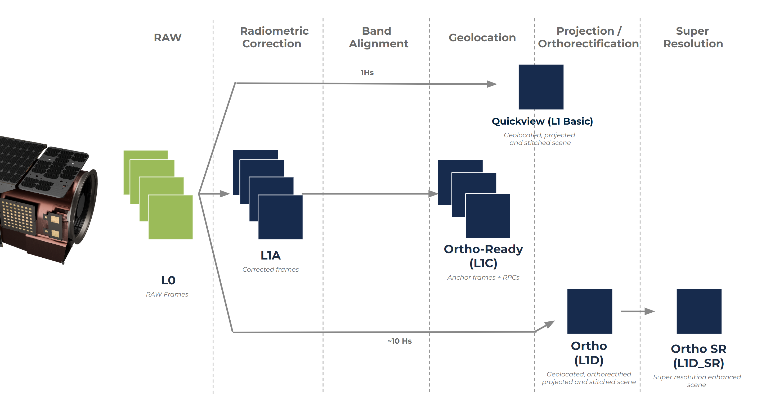
Satellogic offers data captured by our satellites in different imagery product formats. All products are generated from the raw data coming from the satellites, also known as L0 data. The following map provides a schematic view of how the different products are generated by using different processing algorithms:
The different products can be grouped into:
- Raw (L0 and L1A): Raw data, generally used by very advanced users only.
- L1B: radiometrically corrected, projected but not orthorectified for rapid inisghts and detection.
- Ortho Ready (L1C): Radiometrically corrected and band aligned data designed for further orthorectification to be done by users that have their own basemaps, DEMs and GCPs.
- Ortho (L1D, L1D_SR): Radiometrically corrected, orthorectified and projected imagery for scientific and commercial use.
All products are available for Mark IV and V satellites families from their respective multispectral and hyperspectral payloads.
Product versioning
All products adhere to Semantic versioning, meaning that:
Given a version number MAJOR.MINOR.PATCH,
- MAJOR version changes for incompatible API changes
- MINOR version changes for added functionality in a backward compatible manner
- PATCH version changes for backward compatible bug fixes