# Your Gateway to NASA 
Earth Observation Data | NASA Earthdata (original) (raw)

Chinese Liaoning and Shandong carriers docked at Yulin Naval Base, captured in a high-resolution SAR image by Capella Space. © 2025 Capella Space.

Learn more about the NASA Commercial Satellite Data Acquisition (CSDA) program vendor Capella Space and how to discover, access, and work with their SAR data products.

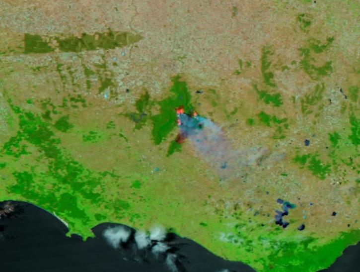
False-color corrected reflectance image of bushfires in Grampian National Park, Australia on 25 December 2024 from the VIIRS instrument aboard the NOAA-21 satellite

Worldview Image of the Week

Image captured on Dec 25, 2024, by the VIIRS instrument aboard the NOAA-21 platform.

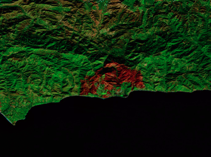
False-color reflectance image of burned area from the Franklin Fire, Malibu, California on December 18, 2024 from the MSI instrument aboard ESA's Sentinel-2B platform.

Worldview Image of the Week

Image captured on Dec 18, 2024, by the MSI instrument aboard ESA's Sentinel-2B platform.

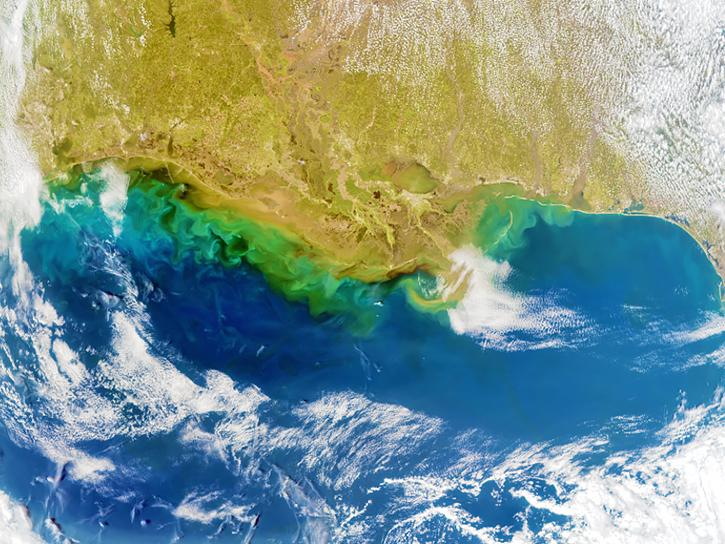
A satellite image of Earth shows blue water, tan land, green shading along the coastline, and wispy white clouds.

Submit your abstract to this International Geoscience and Remote Sensing Symposium (IGARSS) session, which focuses on the benefits of fusing visible to short-wave infrared (VSWIR) hyperspectral and thermal infrared data.

image of chart bars overlayed on Earth map projection

The Tropospheric Emissions: Monitoring of Pollution (TEMPO) instrument collected its “first light” measurements of nitrogen dioxide air pollution over North America on August 2, 2023. This image shows TEMPO measurements of nitrogen dioxide over Southern California at 12:14 pm EDT.

Image of high nitrogen dioxide levels from the Franklin Fire and Los Angeles on December 10, 2024 from the TEMPO instrument aboard the Intelsat-40e satellite

Worldview Image of the Week

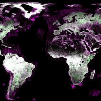
This image shows the globe color coded to indicate its surface type. Most of the image is black to indicate calm water, the ocean, or dry sand. Rough water is depicted in shades of purple. The continents are shaded in green where there is vegetation, and white where there are urban areas or little vegetation.

Open Science

We empower an inclusive, collaborative scientific process through the open sharing of data and knowledge. Our open data, services, and software policies ensure that data are fully available to any user for any purpose.

Earth Science Data Systems 2023 Fiscal Year Highlights
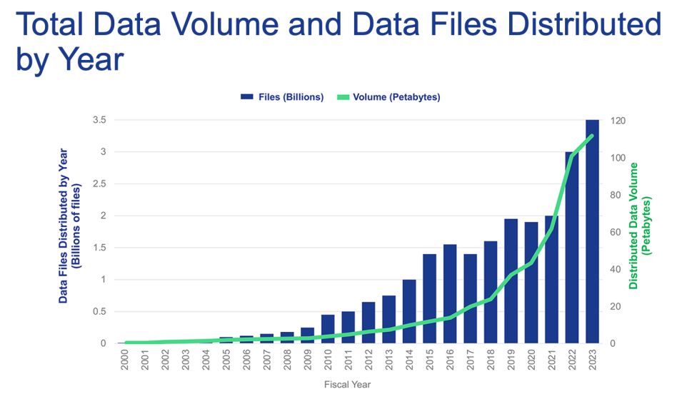
This is a chart showing over 3.5 billion files distributed in FY23 with a data volume of over 100 petabytes.

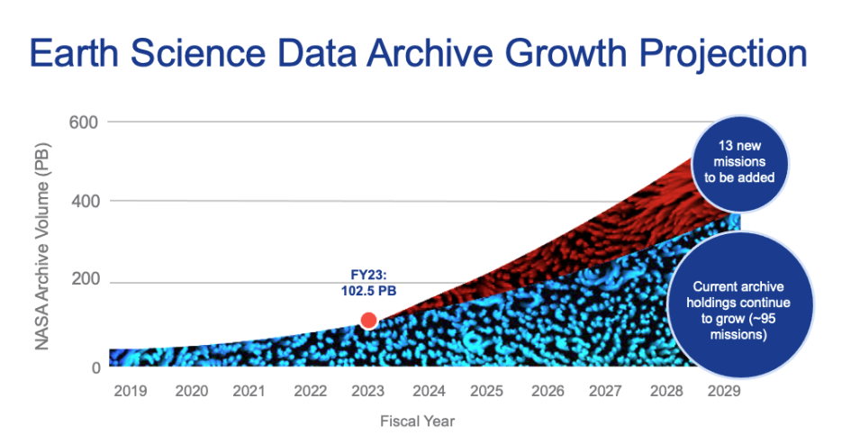
This is a chart showing the data archive growth projection to soar to over 500 petabytes by the year 2029.

2.7 billion

files distributed to end users

5+ million

distinct data and service users

100+ petabytes

of Earth science data available