A clickable map of world countries :-) (original) (raw)
Home » World Maps » World Map
World Map - Political - Click a Country


Political Map of the World
Shown above
The map above is a political map of the world centered on Europe and Africa. It shows the location of most of the world's countries and includes their names where space allows.
Representing a round earth on a flat map requires some distortion of the geographic features no matter how the map is done. We have used a Mercator projection for this map because it is the projection most commonly used in schools. On this map, geographic boundaries that trend north-south appear as vertical lines, geographic boundaries that trend east-west appear as horizontal lines. This type of projection causes a minimum of country-shape distortion near the equator, a small amount of distortion at mid-latitudes, but extreme distortion near the poles. For that reason, the map does not extend to the north and south poles.

Types of Maps
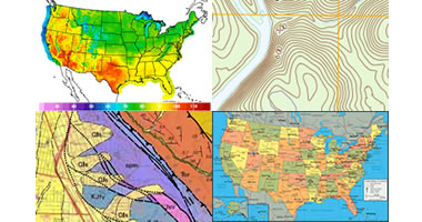
Did you know that there are thousands of types of maps? Learn about the maps shown here and more.
Countries of the World

We have maps and information for almost every country in the world, from Afghanistan to Zimbabwe.
World Physical Map

Physical Map of the World
Shown above
The map shown here is a terrain relief image of the world with the boundaries of major countries shown as white lines. It includes the names of the world's oceans and the names of major bays, gulfs, and seas. Lowest elevations are shown as a dark green color with a gradient from green to dark brown to gray as elevation increases. This allows the major mountain ranges and lowlands to be clearly visible.
This map is also a Mercator projection centered on Europe and Africa. A scale of miles is not shown on these maps because the scale changes with distance north and south of the equator. Scale is highly exaggerated as distance from the equator increases.
Note: The map above shows names and political boundaries as depicted on maps published by the CIA World Factbook, which we use as our primary reference for geographic information as recognized by the United States.
Countries of the World:
The United States Department of State recognizes 195 "Independent States in the World". We have listed these countries below, and those that we have a map for are clickable.Copyright information: The images on this page were composed by Angela King and Brad Cole and are copyright by Geology.com. These images are not available for use beyond our websites. If you would like to share them with others please link to this page. The maps were produced using digital vector graphics licensed from and copyright by Map Resources.