Heege, Thomas - Profile on Academia.edu (original) (raw)
Papers by Heege, Thomas
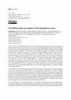
International Hydrographic Review, Nov 1, 2022
Satellite-Derived Bathymetry (SDB) methods have found their way into the hydrographers' toolbox a... more Satellite-Derived Bathymetry (SDB) methods have found their way into the hydrographers' toolbox and are part of integrated survey concepts, nautical charts and support global and European programs such as Seabed2030 or EMODnet Bathymetry. The concept of the 'physics-based' SDB describes the calculation of bathymetry by modelling the sunlight path from the sun to the seafloor to the satellite sensor. It is a highly sophisticated model which enables the calculation of shallow water depth in the absence of any other survey or ground-truth data. Thus, bathymetric data can also be retrieved for remote and inaccessible areas -in contrast to empirical SDB approaches. Key questions which arise for SDB results are vertical accuracy, potential and feasibility for different sites and the methods to upscale SDB solutions. These questions are addressed in the current European innovation project 4S. Within the project SDB-Online was developed, a fully physics-based SDB concept which is installed in a cloud and accessible via a web user interface. The backend is parallelised and can be accessed via application programming interface (API) which allows a fully scalable and automatic SDB processing. In this study SDB-Online results are validated at ten sites, ranging from the higher latitudes of Canada to turbid UK waters to the Caribbean. Furthermore, a relationship between the Secchi Disc Depth and the cutoff depth of the SDB results is established and a global map of water-clarity potential of the SDB solution is presented.

Hyperspectral remote sensing of the intertidal and subtidal zone at Helgoland: running projects, initial results, plans 2011
Remote sensing techniques and in situ fluorometry as alternative methods for the determination of algae pigments in lakes - application to Lake Constance and small lakes
EGUGA, May 1, 2014
Satellite derived Bathymetry and Digital Elevation Models (DEM)
Abstract In 2010, Qatar Shell Upstream International B.V. (QSUI) re-entered Exploration in Qatar ... more Abstract In 2010, Qatar Shell Upstream International B.V. (QSUI) re-entered Exploration in Qatar focusing on the relatively deep conventional Pre-Khuff gas plays with a view to discover additional hydrocarbons in the State of Qatar. In order to support Qatar Shell with the execution of onshore and offshore seismic programs, satellite imagery was used extensively to derive added value products in terms of shallow water bathymetry, seabed classification and onshore digital elevation models (DEM). For the offshore bathymetry and seabed classification products, 2m resolution multispectral WorldView-2 satellite scenes were processed following a data processing chain including the correction of atmospheric adjacency (increased radiance over water due to reflection of photons by the nearby land and their further scattering in the atmosphere), water surface and water column effects. The resulting offshore products had a spatial resolution of 4m and covered an area of ~700 km2. For the onshore elevation product, a 50cm WorldView-1 stereo image pair was processed using a photogrammetric stereo vision algorithm to generate a 1m spatial resolution DEM over an area of ∼450 km2. The accuracy and quality of these satellite image derived products depend largely on the optical conditions of the satellite scene, the sensitivity of the satellite sensor and the accuracy of the calibration. Three types of independent control datasets were used to assess the quality and accuracy of the bathymetry and DEM; airborne LiDAR sounding transects, multibeam echo sounding swaths (offshore) and seismic survey lines (onshore and offshore). After correction for any systematic bias, the correlation of both products with the control data was found to be very good with <1m vertical error in general. Satellite image products are recognized within QSUI as a key technology to aid the planning and preparation of seismic operations and site evaluation by improving hazard identification and reducing field risk exposure early on in the project life cycle. In addition, cost savings were realized compared to more costly traditional acquisition methods. The seismic field conditions were assessed relatively quickly compared to the time frame required for traditional methods. This allowed the data to be included in commercial tendering which in turn resulted in sharper bids. In conclusion, satellite imagery in combination with the right processing techniques has the potential to provide an integrated wide area bathymetry and DEM coverage at relatively high resolution and low cost.
Improving global water quality information by combining in-situ data, remote sensing and modeling
Achieving good ambient water quality for rivers, lakes and groundwater is anchored in the Sustain... more Achieving good ambient water quality for rivers, lakes and groundwater is anchored in the Sustainable Development Goals (SDGs). Poor water quality has considerable impacts on ecosystem integrity, human health, and food security. Information on the state of water quality is the basis for decision-making on pollution reduction measures.To date, water quality information has mostly relied on data from on-site sampling and, increasingly, sensor-based monitoring stations. Despite the increasing amount of in-situ data and growing efforts to make these data easily accessible, spatial coverage and temporal consistency are not sufficient to provide comprehensive water quality information worldwide. In-situ data are particularly missing in low-income countries and regions known for their lack of data sharing policy . Therefore, it is necessary to tap into additional methods to obtain water quality information worldwide.Data from satellites can provide information on optical water quality para...
Global Lakes Sentinel Services: Monitoring Water Quality Trends in Deep, Clear Lakes to Detect Causes and Effects of Changes in Trophic Status
Sentinel-3 for Science Workshop, Dec 1, 2015
APPS4GMES- Development Of Operational Products And Services For GMES- A Bavarian Initiative
Global Lakes Sentinel Services: Evaluation of CHL-A Trends in Deep Clear Lakes
Flugzeuggestützte Fernerkundung von Wasserinhaltsstoffen am Bodensee
Planned investigations with MOS above Lake Constance
Many Earth observing sensors have been designed, built and launched with primary objectives of ei... more Many Earth observing sensors have been designed, built and launched with primary objectives of either terrestrial or ocean remote sensing applications. Often the data from these sensors are also used for freshwater, estuarine and coastal water quality observations and bathymetry and benthic mapping. However, such land and ocean specific sensors are not designed for these complex aquatic environments and consequently are not likely to perform as well as a dedicated sensor would. As a CEOS action, CSIRO and DLR have taken the lead on a feasibility assessment to determine the benefits and technological difficulties of designing an Earth observing satellite mission focused on the biogeochemistry of inland, estuarine, deltaic and near coastal waters as well as mapping macrophytes, macro-algae, sea grasses and coral reefs. These environments need higher spatial resolution than current and planned ocean colour sensors offer and need higher spectral resolution than current and planned land ...
A study on optical parameters of the atmosphere
A hyperspectral, remote-sensing approach to spectral discrimination of marine habitats at Ningaloo Reef, Western Australia
Optical remote-sensing techniques, especially hyperspectral sensors, provide an non-invasive and ... more Optical remote-sensing techniques, especially hyperspectral sensors, provide an non-invasive and cost-effective approach to mapping and monitoring the condition of reefs over large areas because of their capability to identify reef components on the basis of their spectral response. The aim of this study is to develop a reliable and repeatable procedure for mapping submerged coral reefs using airborne hyperspectral data. Spectral reflectance of corals, macro-algae and sediment were measured underwater with an ...
Ningaloo Reef: high resolution mapping achieved with hyperspectral, remotely-sensed data
Effective management and monitoring of coral reef systems requires detailed baseline data about t... more Effective management and monitoring of coral reef systems requires detailed baseline data about the distribution of marine habitats. Reefs with clear waters and complex geomorphology, such as Ningaloo Reef in Western Australia, naturally lend themselves to the application of optical remote sensing as a means of gathering information about benthic habitats, bathymetry, and adjacent coastal environments. Using HyMap hyperspectral data with 3.5 m pixel resolution, we were able to retrieve very detailed information about the ...

Einführung in die Karten- und Luftbildinterpretation

A physically based, simultaneous air/water constituent algorithm is used for automatic processing... more A physically based, simultaneous air/water constituent algorithm is used for automatic processing of 5 MERIS level 1B FR datasets of Lake Constance. Its sensitivity to the adjacency correction tool ICOL is tested, and compared to variations in the wavelength dependence of aerosols. Further comparisons are made with MERIS NN algorithms for eutrophic lakes and case II waters. Reference data measured during the MERIS lakes field campaign in April 2007 is used, consisting of both direct concentration and optical in situ measurements. AERONET data of the two closest stations are evaluated. A good representation of a pattern of extending suspended matter is found for adjacency corrected MIP outputs and MERIS NN products, while chlorophyll and gelbstoff are insufficient.

The Applied Remote Sensing Cluster at the German Aerospace Center DLR has long lasting experience... more The Applied Remote Sensing Cluster at the German Aerospace Center DLR has long lasting experiences with air- and spaceborne acquisition and processing of hyperspectral image data. Jointly with the German Space Operations Center it is responsible for the establishment of the ground segment of the future German hyperspectral satellite mission EnMAP (Environmental Mapping and Analysis Program) which is planned to be launched in 2013. The primary goal of EnMAP is to quantify and analyze diagnostic parameters describing key processes on the Earth’s surface. Extensive calibration and validation activities are foreseen during the planned five years of operations to ensure high quality data products, which include radiometric, geometric and atmospheric correction. This paper focuses on the automatic processing chain, as well as the calibration and quality control activities for the generation of standard EnMAP products.

Many Earth observing sensors have been designed, built and launched with primary objectives of ei... more Many Earth observing sensors have been designed, built and launched with primary objectives of either terrestrial or ocean remote sensing applications. Often the data from these sensors are also used for freshwater, estuarine and coastal water quality observations, bathymetry and benthic mapping. However, such land and ocean specific sensors are not designed for these complex aquatic environments and consequently are not likely to perform as well as a dedicated sensor would. As a CEOS action, CSIRO and DLR have taken the lead on a feasibility assessment to determine the benefits and technological difficulties of designing an Earth observing satellite mission focused on the biogeochemistry of inland, estuarine, deltaic and near coastal waters as well as mapping macrophytes, macro-algae, sea grasses and coral reefs. These environments need higher spatial resolution than current and planned ocean colour sensors offer and need higher spectral resolution than current and planned land Ear...