Erik Blasch - Profile on Academia.edu (original) (raw)
Papers by Erik Blasch
IT Professional, Sep 1, 2022
Advancements in generative models, like Deepfake allows users to imitate a targeted person and ma... more Advancements in generative models, like Deepfake allows users to imitate a targeted person and manipulate online interactions. It has been recognized that disinformation may cause disturbance in society and ruin the foundation of trust. This article presents DeFakePro, a decentralized consensus mechanism-based Deepfake detection technique in online video conferencing tools. Leveraging Electrical Network Frequency (ENF), an environmental fingerprint embedded in digital media recording, affords a consensus mechanism design called Proof-of-ENF (PoENF) algorithm. The similarity in ENF signal fluctuations is utilized in the PoENF algorithm to authenticate the media broadcasted in conferencing tools. By utilizing the video conferencing setup with malicious participants to broadcast deep fake video recordings to other participants, the DeFakePro system verifies the authenticity of the incoming media in both audio and video channels.
EAI Endorsed Transactions on Security and Safety, Jul 13, 2018
Large scale Internet of Video Things (IoVT) supports situation awareness for smart cities; howeve... more Large scale Internet of Video Things (IoVT) supports situation awareness for smart cities; however, the rapid development in artificial intelligence (AI) technologies enables fake video/audio streams and doctored images to fool smart city security operators. Authenticating visual/audio feeds becomes essential for safety and security, from which an Electric Network Frequency (ENF) signal collected from the power grid is a prominent authentication mechanism. This paper proposes an ENF-based Video Authentication method using steady Superpixels (EVAS). Video superpixels group the pixels with uniform intensities and textures to eliminate the impacts from the fluctuations in the ENF estimation. An extensive experimental study validated the effectiveness of the EVAS system. Aiming at the environments with interconnected surveillance camera systems at the edge powered by an electricity grid, the proposed EVAS system achieved the design goal of detecting dissimilarities in the image sequences.
IEEE open journal of the Communications Society, 2021
The damage to cellular towers during natural and man-made disasters can disturb the communication... more The damage to cellular towers during natural and man-made disasters can disturb the communication services for cellular users. One solution to the problem is using unmanned aerial vehicles to augment the desired communication network. The paper demonstrates the design of a UAV-Assisted Imitation Learning (UnVAIL) communication system that relays the cellular users' information to a neighbor base station. Since the user equipment (UEs) are equipped with buffers with limited capacity to hold packets, UnVAIL alternates between different UEs to reduce the chance of buffer overflow, positions itself optimally close to the selected UE to reduce service time, and uncovers a network pathway by acting as a relay node. UnVAIL utilizes Imitation Learning (IL) as a data-driven behavioral cloning approach to accomplish an optimal scheduling solution. Results demonstrate that UnVAIL performs similar to a human expert knowledge-based planning in communication timeliness, position accuracy, and energy consumption with an accuracy of 97.52% when evaluated on a developed simulator to train the UAV.
arXiv (Cornell University), Jan 17, 2016
Bird strikes present a huge risk for aircraft, especially since traditional airport bird surveill... more Bird strikes present a huge risk for aircraft, especially since traditional airport bird surveillance is mainly dependent on inefficient human observation. Computer vision based technology has been proposed to automatically detect birds, determine bird flying trajectories, and predict aircraft takeoff delays. However, the characteristics of bird flight using imagery and the performance of existing methods applied to flying bird task are not well known. Therefore, we perform infrared flying bird tracking experiments using 12 state-of-the-art algorithms on a real BIRDSITE-IR dataset to obtain useful clues and recommend feature analysis. We also develop a Struck-scale method to demonstrate the effectiveness of multiple scale sampling adaption in handling the object of flying bird with varying shape and scale. The general analysis can be used to develop specialized bird tracking methods for airport safety, wildness and urban bird population studies.
Connected societies require reliable measures to assure the safety, privacy, and security of memb... more Connected societies require reliable measures to assure the safety, privacy, and security of members. Public safety technology has made fundamental improvements since the first generation of surveillance cameras were introduced, which aims to reduce the role of observer agents so that no abnormality goes unnoticed. While the edge computing paradigm promises solutions to address the shortcomings of cloud computing, e.g., the extra communication delay and network security issues, it also introduces new challenges. One of the main concerns is the limited computing power at the edge to meet the on-site dynamic data processing. In this paper, a Lightweight IoT (Internet of Things) based Smart Public Safety (LISPS) framework is proposed on top of microservices architecture. As a computing hierarchy at the edge, the LISPS system possesses high flexibility in the design process, loose coupling to add new services or update existing functions without interrupting the normal operations, and efficient power balancing. A real-world public safety monitoring scenario is selected to verify the effectiveness of LISPS, which detects, tracks human objects and identify suspicious activities. The experimental results demonstrate the feasibility of the approach.
arXiv (Cornell University), Mar 8, 2019
Video Surveillance Systems (VSS) have become an essential infrastructural element of smart cities... more Video Surveillance Systems (VSS) have become an essential infrastructural element of smart cities by increasing public safety and countering criminal activities. A VSS is normally deployed in a secure network to prevent the access from unauthorized personnel. Compared to traditional systems that continuously record video regardless of the actions in the frame, a smart VSS has the capability of capturing video data upon motion detection or object detection, and then extracts essential information and send to users. This increasing design complexity of the surveillance system, however, also introduces new security vulnerabilities. In this work, a smart, real-time frame duplication attack is investigated. We show the feasibility of forging the video streams in real-time as the camera's surroundings change. The generated frames are compared constantly and instantly to identify changes in the pixel values that could represent motion detection or changes in light intensities outdoors. An attacker (intruder) can remotely trigger the replay of some previously duplicated video streams manually or automatically, via a special quick response (QR) code or when the face of an intruder appear in the camera field of view. A detection technique is proposed by leveraging the real-time electrical network frequency (ENF) reference database to match with the power grid frequency.
arXiv (Cornell University), Feb 27, 2019
Thanks to rapid technological advances in the Internet of Things (IoT), a smart public safety (SP... more Thanks to rapid technological advances in the Internet of Things (IoT), a smart public safety (SPS) system has become feasible by integrating heterogeneous computing devices to collaboratively provide public protection services. While a service oriented architecture (SOA) has been adopted by IoT and cyberphysical systems (CPS), it is difficult for a monolithic architecture to provide scalable and extensible services for a distributed IoT based SPS system. Furthermore, traditional security solutions rely on a centralized authority, which can be a performance bottleneck or single point failure. Inspired by microservices architecture and blockchain technology, this paper proposes a BLockchain-ENabled Decentralized Microservices Architecture for Smart public safety (BlendMAS). Within a permissioned blockchain network, a microservices based security mechanism is introduced to secure data access control in a SPS system. The functionality of security services are decoupled into separate containerized microservices that are built using a smart contract, and deployed on edge and fog computing nodes. An extensive experimental study verified that the proposed BlendMAS is able to offer a decentralized, scalable and secured data sharing and access control to distributed IoT based SPS system.
arXiv (Cornell University), Jul 16, 2018
Information from surveillance video is essential for situational awareness (SAW). Nowadays, a pro... more Information from surveillance video is essential for situational awareness (SAW). Nowadays, a prohibitively large amount of surveillance data is being generated continuously by ubiquitously distributed video sensors. It is very challenging to immediately identify the objects of interest or zoom in suspicious actions from thousands of video frames. Making the big data indexable is critical to tackle this problem. It is ideal to generate pattern indexes in a real-time, on-site manner on the video streaming instead of depending on the batch processing at the cloud centers. The modern edge-fog-cloud computing paradigm allows implementation of time sensitive tasks at the edge of the network. The on-site edge devices collect the information sensed in format of frames and extracts useful features. The near-site fog nodes conduct the contextualization and classification of the features. The remote cloud center is in charge of more data intensive and computing intensive tasks. However, exchanging the index information among devices in different layers raises security concerns where an adversary can capture or tamper with features to mislead the surveillance system. In this paper, a blockchain enabled scheme is proposed to protect the index data through an encrypted secure channel between the edge and fog nodes. It reduces the chance of attacks on the small edge and fog devices. The feasibility of the proposal is validated through intensive experimental analysis.
arXiv (Cornell University), Mar 9, 2020
Situation AWareness (SAW) is essential for many mission critical applications. However, SAW is ve... more Situation AWareness (SAW) is essential for many mission critical applications. However, SAW is very challenging when trying to immediately identify objects of interest or zoom in on suspicious activities from thousands of video frames. This work aims at developing a queryable system to instantly select interesting content. While face recognition technology is mature, in many scenarios like public safety monitoring, the features of objects of interest may be much more complicated than face features. In addition, human operators may not be always able to provide a descriptive, simple, and accurate query. Actually, it is more often that there are only rough, general descriptions of certain suspicious objects or accidents. This paper proposes an Interactive Video Surveillance as an Edge service (I-ViSE) based on unsupervised feature queries. Adopting unsupervised methods that do not reveal any private information, the I-ViSE scheme utilizes general features of a human body and color of clothes. An I-ViSE prototype is built following the edge-fog computing paradigm and the experimental results verified the I-ViSE scheme meets the design goal of scene recognition in less than two seconds.
arXiv (Cornell University), Sep 12, 2019
Urban imagery usually serves as forensic analysis and by design is available for incident mitigat... more Urban imagery usually serves as forensic analysis and by design is available for incident mitigation. As more imagery collected, it is harder to narrow down to certain frames among thousands of video clips to a specific incident. A real-time, proactive surveillance system is desirable, which could instantly detect dubious personnel, identify suspicious activities, or raise momentous alerts. The recent proliferation of the edge computing paradigm allows more data-intensive tasks to be accomplished by smart edge devices with lightweight but powerful algorithms. This paper presents a forensic surveillance strategy by introducing an Instant Suspicious Activity identiFication at the Edge (I-SAFE) using fuzzy decision making. A fuzzy control system is proposed to mimic the decision-making process of a security officer. Decisions are made based on video features extracted by a lightweight Deep Machine Learning (DML) model. Based on the requirements from the first-line law enforcement officers, several features are selected and fuzzified to cope with the state of uncertainty that exists in the officers decision-making process. Using features in the edge hierarchy minimizes the communication delay such that instant alerting is achieved. Additionally, leveraging the Microservices architecture, the I-SAFE scheme possesses good scalability given the increasing complexities at the network edge. Implemented as an edgebased application and tested using exemplary and various labeled dataset surveillance videos, the I-SAFE scheme raises alerts by identifying the suspicious activity in an average of 0.002 seconds. Compared to four other state-of-the-art methods over two other data sets, the experimental study verified the superiority of the I-SAFE decentralized method.
arXiv (Cornell University), Oct 27, 2021
During natural disasters, aircraft and satellites are used to survey the impacted regions. Usuall... more During natural disasters, aircraft and satellites are used to survey the impacted regions. Usually human experts are needed to manually label the degrees of the building damage so that proper humanitarian assistance and disaster response (HADR) can be achieved, which is labor-intensive and time-consuming. Expecting human labeling of major disasters over a wide area gravely slows down the HADR efforts. It is thus of crucial interest to take advantage of the cutting-edge Artificial Intelligence and Machine Learning techniques to speed up the natural infrastructure damage assessment process to achieve effective HADR. Accordingly, the paper demonstrates a systematic effort to achieve efficient building damage classification. First, two novel generative adversarial nets (GANs) are designed to augment data used to train the deep-learning-based classifier. Second, a contrastive learning based method using novel data structures is developed to achieve great performance. Third, by using information fusion, the classifier is effectively trained with very few training data samples for transfer learning. All the classifiers are small enough to be loaded in a smart phone or simple laptop for first responders. Based on the available overhead imagery dataset, results demonstrate data and computational efficiency with 10% of the collected data combined with a GAN reducing the time of computation from roughly half a day to about 1 hour with roughly similar classification performances.
arXiv (Cornell University), Jun 25, 2018
Context enhancement is critical for night vision (NV) applications, especially for the dark night... more Context enhancement is critical for night vision (NV) applications, especially for the dark night situation without any artificial lights. In this paper, we present the infraredto-visual (IR2VI) algorithm, a novel unsupervised thermalto-visible image translation framework based on generative adversarial networks (GANs). IR2VI is able to learn the intrinsic characteristics from VI images and integrate them into IR images. Since the existing unsupervised GAN-based image translation approaches face several challenges, such as incorrect mapping and lack of fine details, we propose a structure connection module and a region-of-interest (ROI) focal loss method to address the current limitations. Experimental results show the superiority of the IR2VI algorithm over baseline methods.
arXiv (Cornell University), Apr 16, 2019
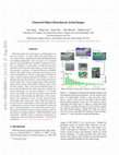
Detecting objects in aerial images is challenging for at least two reasons: (1) target objects li... more Detecting objects in aerial images is challenging for at least two reasons: (1) target objects like pedestrians are very small in pixels, making them hardly distinguished from surrounding background; and (2) targets are in general sparsely and non-uniformly distributed, making the detection very inefficient. In this paper, we address both issues inspired by observing that these targets are often clustered. In particular, we propose a Clustered Detection (ClusDet) network that unifies object clustering and detection in an end-to-end framework. The key components in ClusDet include a cluster proposal sub-network (CPNet), a scale estimation sub-network (ScaleNet), and a dedicated detection network (DetecNet). Given an input image, CPNet produces object cluster regions and ScaleNet estimates object scales for these regions. Then, each scale-normalized cluster region is fed into DetecNet for object detection. ClusDet has several advantages over previous solutions: (1) it greatly reduces the number of chips for final object detection and hence achieves high running time efficiency, (2) the clusterbased scale estimation is more accurate than previously used single-object based ones, hence effectively improves the detection for small objects, and (3) the final DetecNet is dedicated for clustered regions and implicitly models the prior context information so as to boost detection accuracy. The proposed method is tested on three popular aerial image datasets including VisDrone, UAVDT and DOTA. In all experiments, ClusDet achieves promising performance in comparison with state-of-the-art detectors. Code will be available in .
arXiv (Cornell University), Jul 30, 2018
Edge computing provides the ability to link distributor users for multimedia content, while retai... more Edge computing provides the ability to link distributor users for multimedia content, while retaining the power of significant data storage and access at a centralized computer. Two requirements of significance include: what information show be processed at the edge and how the content should be stored. Answers to these questions require a combination of query-based search, access, and response as well as indexedbased processing, storage, and distribution. A measure of intelligence is not what is known, but is recalled; hence, future edge intelligence must provide recalled information for dynamic response. In this paper, a novel event-oriented indexable and queryable intelligent surveillance (EIQIS) system is introduced leveraging the on-site edge devices to collect the information sensed in format of frames and extracts useful features to enhance situation awareness.The design principles are discussed and a preliminary proof-of-concept prototype is built that validated the feasibility of the proposed idea.
IEEE Access
This paper presents a robust system for mitigating adversarial and natural GPS disruptions by pre... more This paper presents a robust system for mitigating adversarial and natural GPS disruptions by presenting: (1) a software-based defense mechanism against spoofing attacks using generative adversarial networks (GANs), The system detects unauthorized or spoofed GPS signals from a hardware based spoofer, and (2) deep neural network models to infer positioning information in GPS-degraded /denied environments using the novel idea of GPS satellite constellation fingerprint. As the GAN and Satellite constellation fingerprinting are used together in a unified framework, we call it the ''GANSAT positioning system.'' Intuitively, the GANSAT neural networks implicitly learn a representation of the aggregation of the hardware fingerprints of the satellite's in the GPS constellation at a given location and time. To demonstrate the approach, raw GPS signals were collected from the satellite transmitters using a software defined radio (SDR) at five different locations in the Florida panhandle area of the United States. Additionally, a GPS spoofer is implemented using a SDR and an open source software and used in an uncontrolled laboratory environment for spoofing the GPS signals at the aforementioned locations. In our experiments, the GANSAT framework yields ∼99.5% accuracy for the task of identifying and filtering the spoofed GPS signals from real ones. It also achieves ∼100% accuracy for the task of location estimation.
2019 Winter Simulation Conference (WSC), 2019
A seamless communication capability is important in military operations. Likewise, enhanced secur... more A seamless communication capability is important in military operations. Likewise, enhanced security, increased capacity, and robust communication mechanisms are vital for humanitarian and disaster-response operations. Often, a system of wide-band satellites is employed for real-time exchange of information and over-the-horizon control, but the communications are prone to denial of service (DoS) attacks, and delayed redeployment. Hence, a swarm of drones could be deployed in mission-critical operations in times of urgency for a secured and robust distributed-intercommunication which is essential for survivability and successful completion of missions. In this paper, a distributed-agent-based framework for secure and reliable information exchange between drones in a constellation is proposed. The framework comprises a mechanism for path planning simulation and estimation, a flexible network architecture for improved clientserver(C/S) and peer-to-peer (P2P) connectivity, as well as agents for identity authentications and secure communications. The framework has been simulated and verified with results showing promise.
Proceedings of the 19th ACM Conference on Embedded Networked Sensor Systems, 2021
Rapid advances in the Internet of Video Things (IoVT) deployment in modern smart cities has enabl... more Rapid advances in the Internet of Video Things (IoVT) deployment in modern smart cities has enabled secure infrastructures with minimal human intervention. However, attacks on audio-video inputs affect the reliability of large-scale multimedia surveillance systems as attackers are able to manipulate the perception of live events. For example, Deepfake audio/video attacks and frame duplication attacks can cause significant security breaches. This paper proposes a Lightweight Environmental Fingerprint Consensus based detection of compromised smart cameras in edge surveillance systems (LEFC). LEFC is a partial decentralized authentication mechanism that leverages Electrical Network Frequency (ENF) as an environmental fingerprint and distributed ledger technology (DLT). An ENF signal carries randomly fluctuating spatio-temporal signatures, which enable digital media authentication. With the proposed DLT consensus mechanism named Proof-of-ENF (PoENF) as a backbone, LEFC can estimate and authenticate the media recording and detect byzantine nodes controlled by the perpetrator. The experimental evaluation shows feasibility and effectiveness of proposed LEFC scheme under a distributed byzantine network environment. • Security and privacy → Authentication.
2018 Winter Simulation Conference (WSC), 2018
Dynamic Data Driven Applications Systems (DDDAS) is a paradigm where data is dynamically integrat... more Dynamic Data Driven Applications Systems (DDDAS) is a paradigm where data is dynamically integrated into an executing application, and in reverse, the application dynamically steers the measurement process in a feedback control loop. Since its inception in 2000, the DDDAS concept has been successfully applied to a host of application areas. New technologies are emerging such as big data, the Internet of Things, and cloud/edge computing. With these trends DDDAS is poised to have large-scale impacts in areas such as smart cities, manufacturing, health care, and security, to name a few. Each author describes their views concerning the important research challenges facing the DDDAS paradigm and opportunities for impact in the years ahead.
Computer Networks, 2021
Wildfires are one of the costliest and deadliest natural disasters in the US, causing damage to m... more Wildfires are one of the costliest and deadliest natural disasters in the US, causing damage to millions of hectares of forest resources and threatening the lives of people and animals. Of particular importance are risks to firefighters and operational forces, which highlights the need for leveraging technology to minimize danger to people and property. FLAME (Fire Luminosity Airbornebased Machine learning Evaluation) offers a dataset of aerial images of fires along with methods for fire detection and segmentation which can help firefighters and researchers to develop optimal fire management strategies. This paper provides a fire image dataset collected by drones during a prescribed burning piled detritus in an Arizona pine forest. The dataset includes video recordings and thermal heatmaps captured by infrared cameras. The captured videos and images are annotated, and labeled frame-wise to help researchers easily apply their fire detection and modeling algorithms. The paper also highlights solutions to two machine learning problems: (1) Binary classification of video frames based on the presence [and absence] of fire flames. An Artificial Neural Network (ANN) method is developed that achieved a 76% classification accuracy. (2) Fire detection using segmentation methods to precisely determine fire borders. A deep learning method is designed based on the U-Net

Proceedings of the 4th ACM/IEEE Symposium on Edge Computing, 2019
Urban imagery usually serves as forensic analysis and by design is available for incident mitigat... more Urban imagery usually serves as forensic analysis and by design is available for incident mitigation. As more imagery collected, it is harder to narrow down to certain frames among thousands of video clips to a specific incident. A real-time, proactive surveillance system is desirable, which could instantly detect dubious personnel, identify suspicious activities, or raise momentous alerts. The recent proliferation of the edge computing paradigm allows more data-intensive tasks to be accomplished by smart edge devices with lightweight but powerful algorithms. This paper presents a forensic surveillance strategy by introducing an Instant Suspicious Activity identiFication at the Edge (I-SAFE) using fuzzy decision making. A fuzzy control system is proposed to mimic the decision-making process of a security officer. Decisions are made based on video features extracted by a lightweight Deep Machine Learning (DML) model. Based on the requirements from the first-line law enforcement officers, several features are selected and fuzzified to cope with the state of uncertainty that exists in the officers decision-making process. Using features in the edge hierarchy minimizes the communication delay such that instant alerting is achieved. Additionally, leveraging the Microservices architecture, the I-SAFE scheme possesses good scalability given the increasing complexities at the network edge. Implemented as an edgebased application and tested using exemplary and various labeled dataset surveillance videos, the I-SAFE scheme raises alerts by identifying the suspicious activity in an average of 0.002 seconds. Compared to four other state-of-the-art methods over two other data sets, the experimental study verified the superiority of the I-SAFE decentralized method.